
OS grid reference SK148161 Post town BURTON-ON-TRENT Local time Sunday 7:43 PM | Sovereign state United Kingdom Postcode district DE13 Dialling code 01283 | |
 | ||
Weather 11°C, Wind E at 19 km/h, 69% Humidity | ||
Orgreave is a hamlet in the English county of Staffordshire. It lies in the Trent Valley some 6 1⁄2 miles (10.5 km) north-east of the city of Lichfield, the A513 road runs to the south of the hamlet.
Map of Orgreave, Burton-on-Trent, UK
Historically Orgreave was a township of Alrewas and included the hamlet of Overley which is located between them at grid reference SK160156. Orgreave remains in the civil parish of Alrewas which, in turn, forms part of Lichfield District; until 2009 it was in the parish of Alrewas and Fradley.
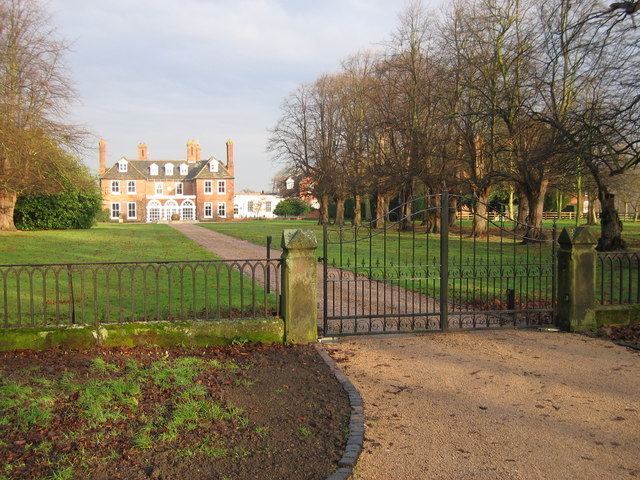
Orgreave Hall, formerly a seat of the Viscounts Anson, is a private home.
References
Orgreave, Staffordshire Wikipedia(Text) CC BY-SA