
Official name Noyyal Orathuppalayam Status Decommissioned Opened 1992 Surface area 220 ha | Country India Opening date 1992 Height 22 m | |
 | ||
Location Kangayam, Tirupur District. Type of dam Embankment with gravity section Similar Aathupalayam Dam, Varattupallam Dam, Perunchani Dam, Vaideki Falls, Vattaparai Falls | ||
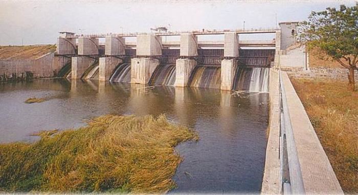
The Noyyal Orathuppalayam Dam and Reservoir, also called Orathuppalayam Dam, is located on the Noyyal River between Chennimalai and Kangayam in Tirupur District, Tamil Nadu, South India. The dam is situated 16 km (9.9 mi) north of Kangayam and 26 km (16 mi) east of Tirupur.
Map of Orathupalayam Dam, Orathupalayam, Tamil Nadu 638751
The dam was built in 1992. It has an ayacut of over 10,000 acres in Tirupur and Karur Districts. It was used by the farmers only for five years as it became a storage tank for textile effluents after that. The farmers, who depended on the dam and river for irrigation, stopped the farm activity in their land.
Due to the sad conversion of Irrigation dam to Effluent tank, the people living down river in the Tirupur, Karur District are negatively affected. From 1992 the deterioration has started and caused migration. Ungampalayam in the K.Paramathi block, Karur district is one such example.
Even the villages near the dam in Chennimalai, Uttukuli area are affected. Kodumanal, famous archaeological site containing Roman coins, potteries and megalithic tombs is severely affected by effluent.