Suvarna Garge (Editor)

Onga District, Fukuoka

Updated on
Edit
Like
Comment
Share on FacebookTweet on TwitterShare on LinkedInShare on Reddit
Onga District, Fukuoka

Points of interest
  
Natsuigahamahamayu Park, Ashiya Seaside Park, Mizumakicho Historical Museum, Okanominato Shrine, Shiroyama

Onga (遠賀郡, Onga-gun) is a district located in Fukuoka Prefecture, Japan.

Contents

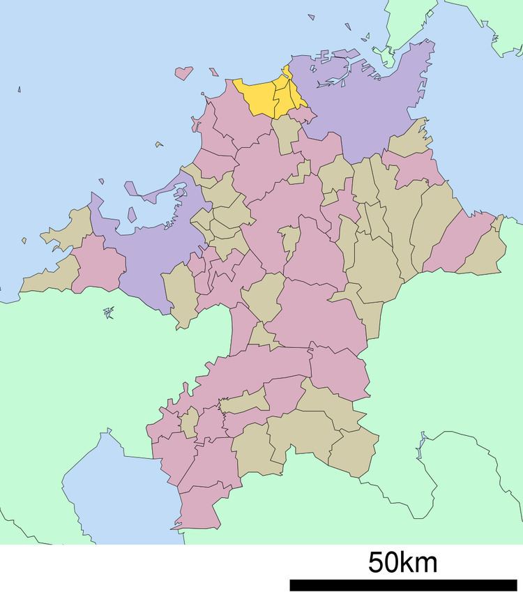
Map of Onga District, Fukuoka Prefecture, Japan

According to 2005 Japanese Census data, the district has a population of 97,537 and a density of 1,045.73 persons per km². The total area is 93.10 km².

Towns currently in this district

  • Ashiya-machi(芦屋町)
  • Mizumaki-machi(水巻町)
  • Okagaki-machi(岡垣町)
  • Onga-chō(遠賀町)
  • The word roots "machi" and "chō" (both written as 町) mean "town." Onga is the only town in Fukuoka Prefecture for which 町 is pronounced "chō." For all other towns it is pronounced "machi."
  • Towns and Villages formerly in this district

  • Katsuki(香月町)- Merged to Yahata City (八幡市. described below) in 1955, currently Yahata Nishi-ku, Kitakyūshū(北九州市八幡西区)
  • Kōjaku Village(上津役村)- Merged to Yahata City in 1937, currently Yahata Nishi-ku, Kitakyūshū
  • Kurosaki(黒崎町)- Merged to Yahata City in 1926, currently Yahata Nishi-ku, Kitakyūshū
  • Nakama(中間町)- Upgraded to City(中間市)status in 1958
  • Orio(折尾町)- Merged to Yahata City in 1944, currently Yahata Nishi-ku, Kitakyūshū
  • Tobata(戸畑町)- Upgraded to City status in 1924, currently Tobata-ku, Kitakyūshū(北九州市戸畑区)
  • Wakamatsu(若松町)- Upgraded to City status in 1914, currently Wakamatsu-ku, Kitakyūshū(北九州市若松区)
  • Yahata(八幡町)- Upgraded to City(八幡市)status in 1917, currently Yahata Higashi-ku, Kitakyūshū(北九州市八幡東区)
  • References

    Onga District, Fukuoka Wikipedia