
Country Philippines Time zone PST (UTC+8) Area 113.3 km² Local time Friday 3:36 PM | Barangays ZIP code 7041 Province Zamboanga Sibugay | |
 | ||
Region Zamboanga Peninsula (Region IX) District 1st District of Zamboanga Sibugay Weather 29°C, Wind S at 11 km/h, 70% Humidity | ||
Olutanga is a fourth class municipality in the province of Zamboanga Sibugay, Philippines. According to the 2015 census, it has a population of 33,671 people.
Contents
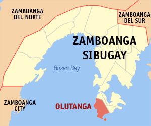
Map of Olutanga, Zamboanga Sibugay, Philippines
The municipality is located in the southwestern part of the eponymous Olutanga Island.
Barangays
Olutanga is subdivided into 19 barangays.
Tertiary
High schools
Primary
References
Olutanga, Zamboanga Sibugay Wikipedia(Text) CC BY-SA