
Type Highway Opened 1920 | Length 52 km (32 mi) Former
route number National Route 1 | |
 | ||
Route number(s) C101
(Berwick-Nar Nar Goon via Pakenham)
C102
(Drouin-Nilma via Warragul)
C103
(Moe-Newborough)
C104
(Morwell-Traralgon) West end Monash Freeway,
Berwick, Melbourne Major settlements Beaconsfield, Pakenham, Drouin, Warragul, Moe, Morwell Via Beaconsfield, Pakenham, Drouin, Warragul, Moe, Morwell | ||
The Old Princes Highway is a 52-kilometre (32 mi) stretch of road, formerly designated as a highway, located in Victoria, Australia. The road links the Princes Highway at Traralgon in the east to the Monash Freeway at Berwick in the west, on the eastern perimeter of Melbourne.
Contents
East
The Old Princes Highway route through the outer south-eastern suburbs of Melbourne and eastern Victoria, along former alignments with which originally Highway 1 had traversed through now runs as bypasses of towns, including Pakenham, Warragul and Moe via the Princes Freeway.
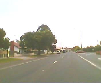
It starts at the junction of Monash Freeway and the Princes Freeway in Berwick as C101 and continues via the town centres of Berwick, Beaconsfield, Officer and Pakenham. The highway rejoins at Nar Nar Goon as an interchange with the Princes Freeway after 23 kilometres (14 mi).
The next superseded section is the C102 via Drouin and Warragul, a distance of 17 kilometres (11 mi), and is more commonly known as the Princes Way. The route runs directly through both of these town centres, starting with Drouin to the south and Warragul to the north of the freeway, where an interchange is provided 3 kilometres (1.9 mi) east of Drouin and 5 kilometres (3.1 mi) west of Warragul between these two towns for traffic wishing to bypass the other town.
Upon proclamation as a State Highway in 1925, the Princes Highway passed through Moe township along what is now Lloyd St and Narracan Dr (C103). From the end of Narracan Drive, the highway descended into the La Trobe Valley through the Haunted Hills, along what is now Haunted Hills Road. From Hernes Oak, the highway passed almost due west through what is now the Yallourn Open Cut Mine to join today’s Morwell Bridge Road at the Morwell River. From there, the Princes Highway used Morwell Bridge Road and what is now Princes Drive (C104) to pass through Morwell.
"The first improvements to the route came in the late 1950s when the expansion of the Yallourn open cut necessitated the relocation of the highway. The CRB took this opportunity to provide a high standard access-controlled alignment as well as a bypass of Moe. The first section of the new highway opened in 1959/60 as a single carriageway super-2 expressway between Hernes Oak and the Morwell River. Following in December 1964 was a westerly extension of the super-2 highway from Hernes Oak to Gunns Gully (Newborough) and the Moe Bypass completed the new route - opening in early 1967. The section between Gunns Gully and Hernes Oak inherited the "Haunted Hills" nickname that applied to the original highway between Newborough and Hernes Oak. Duplication of the Moe-Morwell section was commenced after the opening of the Moe Bypass and completed west to Gunns Gully in 1971 and to the western side of Moe in 1979."
C103 runs via the Moe town centre for 5 kilometres (3.1 mi) before heading north towards Glengarry via an interchange with the freeway at Newborough and C104 (otherwise known as Princes Drive), currently the last of the superseded Highway 1 route traverses for 7 kilometres (4.3 mi) through the Morwell town centre before rejoining the Highway 1 section of the Princes Highway in the western outskirts of Traralgon.
It is anticipated that with the future completion of the Traralgon bypass that a new section of the highway will become superseded from the original Highway 1.
West
The Princes Highway (West) runs from Footscray in the Western suburbs of Melbourne all the way to the South Australian border. Towns along this route have been bypassed by the M1 Princes Freeway and consist of the C109 Princes Highway that runs through Hoppers Crossing into Werribee, and the C109 Geelong Road to Lollypop Creek. Some 60 kilometres (37 mi) later the M1 bypasses Geelong as the Princes Freeway (Geelong Ring Road), with the A10 Princes Highway running through Geelong proper. Within Geelong itself, a 1989 re-alignment of the Princes Highway (as La Trobe Terrace) provides a dual carriageway, 4 lane limited access road to replace the route along Moorabool Street in South Geelong and High Street in Belmont. Upon the completion of the final section (4B-C) of the Geelong Ring Road, another section of the Princes Highway will be superseded in Waurn Ponds.