
Country Canada Established Archville Time zone Eastern (EST) (UTC-5) Elevation 70 m Province Ontario | City Ottawa Annexation 1907 (City of Ottawa) Area 112 ha Population 7,279 (2011) Mayor Jim Watson | |
 | ||
Incorporated 1888 (Village of Ottawa East) Hotels 4899 Uplands Drive Ottawa, St Paul University RCC Restaurants The Green Door Restaurant, Medina Fried Chicken, Lees Greek & Pizza, Café Qui Pense, Giant Panda Restaurant | ||
Old Ottawa East or just Ottawa East (Vieil Ottawa Est in French) is a neighbourhood in Capital Ward in central Ottawa, Canada. It is located south of Nicholas Street and between the Rideau Canal and the Rideau River. The southern border is Avenue Road. To the south is the neighbourhood of Old Ottawa South to the northwest is Sandy Hill. Old Ottawa East includes the Lees Avenue area.
Map of Old Ottawa East, Ottawa, ON, Canada
According to the Canada 2011 Census, the population of the neighbourhood was 7,279
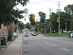
This small neighbourhood was originally the suburban community of Archville that was incorporated as the village of Ottawa East in 1888. In 1907 it was amalgamated with the growing community of Ottawa. Running through the centre of the neighbourhood is Main Street, which was the central road of Archville, but which is not particularly central to modern Ottawa. The neighbourhood is home to Saint Paul University, Lady Evelyn Alternative School, St. Nicholas Adult High School and Immaculata High School.
The southern part of the neighbourhood is sometimes referred to as Rideau Gardens.
Reeves: