
 | ||
Similar Palanga Amber Museum, Lithuanian Sea Museum, Curonian Spit National, Palangos tiltas, ŽEMAITIU ALKA | ||
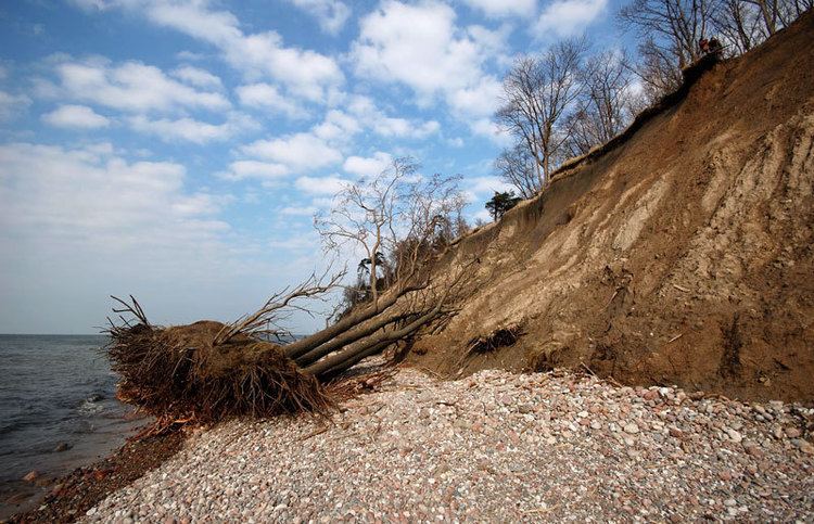
Olando kepurė or Dutchman's Cap is a hill with a 24.4 m high bluff, which is in Lithuania's Seaside Regional Park, near Karklė and 2 km north of Giruliai on the Baltic Sea coast. It was created 12000–15000 years ago during the last Baltic glaciation.
Map of Olandu Kepure, Lithuania
The hill is a parabolic dune created by Aeolian processes on a moraine ridge. The location is now subject to strong erosion by the Baltic Sea, which is exposing various-sized boulders from the moraine. As a consequence, boulder rubble has accumulated on the so-called beach. As the bluff's base is destroyed, earth slips down the bluff's entire face, in an example of mass wasting.
Olando kepurė has long been a navigational guide for sailors and fishermen and so in the early 19th century, markers were erected here and have been shown on charts ever since. A view of the sea with a steep shoreline and stony beaches opens up here. The top of the bluff is a good place to watch birds flying above the sea.