
Area 143 km² Local time Thursday 11:13 PM | Population 2,812 (30 Sep 2016) | |
 | ||
Time zone Japan Standard Time (UTC+9) City hall address 806 Okushiri, Okushiri-chō, Okushiri-gun, Hokkaidō043-1498 Weather 1°C, Wind NW at 14 km/h, 73% Humidity Points of interest Unimaru Park, Kyujimayama, Kitaoimisaki Park, Mount Kamui | ||
Okushiri (奥尻町, Okushiri-chō) is a town encompassing all of Okushiri Island, located in Okushiri District, Hiyama Subprefecture, Hokkaido, Japan.
Contents
- Map of Okushiri District Hokkaido Prefecture Japan
- History
- Sister city
- Transportation
- Education
- References
Map of Okushiri District, Hokkaido Prefecture, Japan
As of 2016, the town has an estimated population of 2,812 and a density of 20 persons per km². The total area is 142.98 km².
Hiyama Prefectural Natural Park encompasses the entire island and town.
History
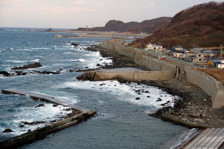
On July 12, 1993, the Southwest Hokkaido Open Sea earthquake (北海道南西沖地震) of magnitude 7.8 in the Sea of Japan off southwest Hokkaido created a devastating tsunami. This tsunami killed 198 people in the town, despite a tsunami warning system and a seawall, and also caused landslides on the hills above. Another 32 people were missing, including 3 in Russia and 129 were injured. The subsequent fire burned down much of what remained. The island was reshaped by the tsunami, which was 10 meters high in town. The tsunami struck within five minutes of the earthquake, leaving residents absolutely no warning.
The name Okushiri comes from the Ainu name Ikusyun-shiri. Iku means other side and shiri means island.
Sister city
Transportation
Okushiri Airport serves the island.