
Width 1.4 km (0.87 mi) Highest point Kvaløyfjellet Elevation 78 m | Length 2.3 km (1.43 mi) Highest elevation 78 m (256 ft) Area 5.5 km² | |
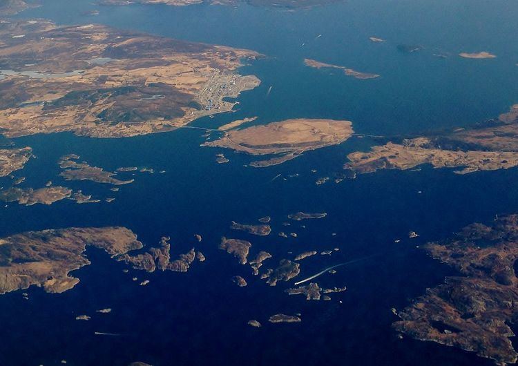 | ||
Ognøya or Ogn is an island in Bokn municipality in Rogaland county, Norway. The 5.5-square-kilometre (2.1 sq mi) island lies between the mainland and the islands of Austre Bokn and Vestre Bokn. The islands are connected by a series of bridges as part of the European route E39 highway. The industrial area of Kårstø lies just north of Ognøya on the mainland.
Map of Ogn%C3%B8ya, 5561 Bokn, Norway
The island is mostly rocky and barren with little population. There is a small group of houses on the southern part of the island in the one relatively flat, arable area on the island. The highest point on the small island is the 78-metre (256 ft) tall Kvaløyfjellet.
References
Ognøya Wikipedia(Text) CC BY-SA