
ZIP codes 51349, 51354 Elevation 480 m Population 473 (2013) Area code 712 | Time zone Central (CST) (UTC-6) FIPS code 19-58530 Area 3 km² Local time Wednesday 5:10 AM | |
 | ||
Weather -4°C, Wind E at 18 km/h, 78% Humidity | ||
Ocheyedan is a city in Osceola County, Iowa, United States. The population was 490 at the 2010 census.
Contents
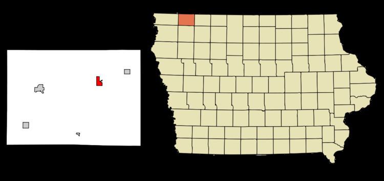
Map of Ocheyedan, IA 51354, USA
History
Ocheyedan had its start in the year 1884 by the building of the Burlington, Cedar Rapids & Northern Railroad through that territory.
Geography
Ocheyedan is located at 43°24′52″N 95°32′7″W (43.414497, -95.535274).
According to the United States Census Bureau, the city has a total area of 1.16 square miles (3.00 km2), all of it land.
There is a common misconception that the highest point in Iowa is the Ocheyedan Mound located near Ocheyedan. The Ocheyedan Mound rises to 1,655 feet above sea level, just fifteen feet short of the actual highest point in Iowa, Hawkeye Point, which has an elevation of 1,670 feet.
2010 census
As of the census of 2010, there were 490 people, 223 households, and 137 families residing in the city. The population density was 422.4 inhabitants per square mile (163.1/km2). There were 252 housing units at an average density of 217.2 per square mile (83.9/km2). The racial makeup of the city was 95.7% White, 0.2% African American, 0.4% Native American, 0.2% Asian, 2.0% from other races, and 1.4% from two or more races. Hispanic or Latino of any race were 3.7% of the population.
There were 223 households of which 24.7% had children under the age of 18 living with them, 53.8% were married couples living together, 4.5% had a female householder with no husband present, 3.1% had a male householder with no wife present, and 38.6% were non-families. 35.9% of all households were made up of individuals and 17.9% had someone living alone who was 65 years of age or older. The average household size was 2.20 and the average family size was 2.84.
The median age in the city was 46.3 years. 20.8% of residents were under the age of 18; 5.9% were between the ages of 18 and 24; 22.2% were from 25 to 44; 28.1% were from 45 to 64; and 22.9% were 65 years of age or older. The gender makeup of the city was 49.6% male and 50.4% female.
2000 census
As of the census of 2000, there were 536 people, 223 households, and 146 families residing in the city. The population density was 461.1 people per square mile (178.4/km²). There were 254 housing units at an average density of 218.5 per square mile (84.5/km²). The racial makeup of the city was 99.63% White, 0.19% from other races, and 0.19% from two or more races. Hispanic or Latino of any race were 0.56% of the population.
There were 223 households out of which 29.6% had children under the age of 18 living with them, 59.6% were married couples living together, 4.9% had a female householder with no husband present, and 34.1% were non-families. 31.8% of all households were made up of individuals and 17.5% had someone living alone who was 65 years of age or older. The average household size was 2.40 and the average family size was 3.04.
Population spread: 25.4% under the age of 18, 8.0% from 18 to 24, 25.9% from 25 to 44, 20.5% from 45 to 64, and 20.1% who were 65 years of age or older. The median age was 40 years. For every 100 females there were 100.7 males. For every 100 females age 18 and over, there were 92.3 males.
The median income for a household in the city was $31,513, and the median income for a family was $36,607. Males had a median income of $29,464 versus $16,944 for females. The per capita income for the city was $14,554. About 5.3% of families and 4.8% of the population were below the poverty line, including 1.5% of those under age 18 and 10.8% of those age 65 or over.