
Incorporated 1857 Demonym(s) Ocañero Population 98,229 (2015) | Founded 1570 Elevation 1,202 m (3,944 ft) Area 672.3 km² | |
 | ||
Weather 18°C, Wind NE at 11 km/h, 90% Humidity Points of interest Museo "Antón García de, Columna de la Libertad, Museo de la Gran Convención, Club Ocaña, Estatua Anton Garcia D | ||
Municipio de oca a norte de santander colombia
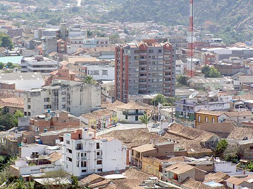
Ocaña is a town and municipality in the Colombian Department of Norte de Santander. Ocaña is the second largest populated center of this department. It played an important role during the Independence of Colombia from the Spanish monarchy.
Contents
- Municipio de oca a norte de santander colombia
- Map of OcaC3B1a North Santander Colombia
- History
- Geography and climate
- Economy
- References
Map of Oca%C3%B1a, North Santander, Colombia
History
The city was founded by Francisco Fernández de Contreras. In 1576 the city was moved to its present location. On April 9, 1828 the National Convention met to discuss the politic and administrative organization of the Republic.
Geography and climate
- Location: 8°14′N 73°21′W. The city of Ocaña is 610 km from Bogotá.
- Surface: 460 km2, 2.2% of the North Santander Department total area
- Height: 1,202 meters on the level of the sea Ocaña are on the Andean Eastern mountain range. The 2,600 mountains surround that reach msnm. Its average temperature is 22 °C.
Economy
The main economic activities are agriculture, the livestock raising, commerce, small industries and mining, with silver operation, copper and iron. The city is served by the Aguas Claras airport.
References
Ocaña, Norte de Santander Wikipedia(Text) CC BY-SA