
Main source Neva Length 8 km | River mouth Ekaterinhofka | |
 | ||
Bridges The American Bridge, Novo-kamenniy Bridge, Tarakanovskiy bridge Similar Obvodny Kanal, Frunzenskaya, Baltiyskaya, Zvenigorodskaya, Volkovskaya | ||
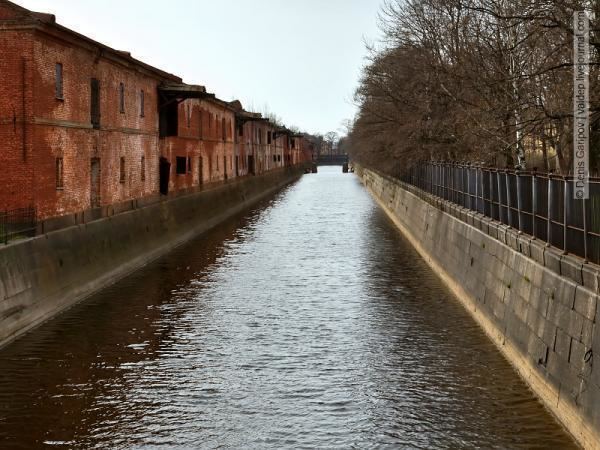
Obvodny Canal (Russian: Обводный канал, lit. Bypass Canal) is the longest canal in Saint Petersburg, Russia, which in the 19th century served as the southern limit of the city. It is 8 kilometres (5 mi) long and flows from the Neva River near Alexander Nevsky Lavra to the Yekaterinhofka not far from the sea port. The canal was dug in 1769–80 and 1805–33. By the late 19th century, after to the Industrial Revolution, it had effectively become a sewer collecting wastewater of adjacent industrial enterprises. Eventually the canal became shallow and no longer navigable. The banks of the canal are lined with granite.
Map of Obvodny Canal, St Petersburg, Russia
References
Obvodny Canal Wikipedia(Text) CC BY-SA