
Country United States FIPS code 19-58395 Elevation 165 m Population 166 (2013) Area code 319 | Time zone Central (CST) (UTC-6) GNIS feature ID 0459778 Zip code 52646 Local time Tuesday 7:22 PM | |
 | ||
Weather 8°C, Wind NW at 14 km/h, 45% Humidity Area 111 ha (109 ha Land / 3 ha Water) | ||
Oakville iowa flood of 2008
Oakville is a city in Louisa County, Iowa, United States. The population was 173 at the 2010 census. It is part of the Muscatine Micropolitan Statistical Area.
Contents
- Oakville iowa flood of 2008
- Map of Oakville IA 52646 USA
- Flood 2008 wapello and oakville iowa
- History
- Geography
- 2010 census
- 2000 census
- June 2008 flooding
- References
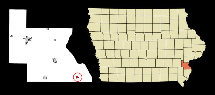
Map of Oakville, IA 52646, USA
Flood 2008 wapello and oakville iowa
History
Oakville was laid out in 1891.
Geography
Oakville is located at 41°5′52″N 91°2′37″W (41.097853, -91.043625).
According to the United States Census Bureau, the city has a total area of 0.43 square miles (1.11 km2), of which, 0.42 square miles (1.09 km2) is land and 0.01 square miles (0.03 km2) is water.
2010 census
As of the census of 2010, there were 173 people, 62 households, and 42 families residing in the city. The population density was 411.9 inhabitants per square mile (159.0/km2). There were 95 housing units at an average density of 226.2 per square mile (87.3/km2). The racial makeup of the city was 97.7% White, 0.6% from other races, and 1.7% from two or more races. Hispanic or Latino of any race were 2.9% of the population.
There were 62 households of which 41.9% had children under the age of 18 living with them, 40.3% were married couples living together, 14.5% had a female householder with no husband present, 12.9% had a male householder with no wife present, and 32.3% were non-families. 29.0% of all households were made up of individuals and 12.9% had someone living alone who was 65 years of age or older. The average household size was 2.79 and the average family size was 3.36.
The median age in the city was 28.3 years. 37% of residents were under the age of 18; 8.6% were between the ages of 18 and 24; 24.9% were from 25 to 44; 20.3% were from 45 to 64; and 9.2% were 65 years of age or older. The gender makeup of the city was 51.4% male and 48.6% female.
2000 census
As of the census of 2000, there were 439 people, 179 households, and 119 families residing in the city. The population density was 1,044.8 people per square mile (403.6/km²). There were 193 housing units at an average density of 459.3 per square mile (177.4/km²). The racial makeup of the city was 99.32% White, 0.46% Asian, and 0.23% from two or more races. Hispanic or Latino of any race were 0.91% of the population.
There were 179 households out of which 33.0% had children under the age of 18 living with them, 49.2% were married couples living together, 12.3% had a female householder with no husband present, and 33.5% were non-families. 28.5% of all households were made up of individuals and 12.3% had someone living alone who was 65 years of age or older. The average household size was 2.45 and the average family size was 2.97.
In the city, the population was spread out with 26.9% under the age of 18, 8.0% from 18 to 24, 28.0% from 25 to 44, 22.6% from 45 to 64, and 14.6% who were 65 years of age or older. The median age was 34 years. For every 100 females there were 99.5 males. For every 100 females age 18 and over, there were 89.9 males.
The median income for a household in the city was $29,018, and the median income for a family was $32,250. Males had a median income of $31,346 versus $21,389 for females. The per capita income for the city was $13,276. About 3.0% of families and 7.7% of the population were below the poverty line, including 8.8% of those under age 18 and 6.1% of those age 65 or over.
June 2008 flooding
Due to the catastrophic statewide major flooding of June 2008, the recovery of the city is under question.