
Country United States Time zone Central (CST) (UTC-6) Elevation 606 m Population 3,700 (2013) | Incorporated 1882 Area code(s) 402 Zip code 68763 Local time Tuesday 11:28 AM | |
 | ||
Weather 0°C, Wind NE at 13 km/h, 93% Humidity | ||
O'Neill is a city in Holt County, Nebraska, United States. The population was 3,705 at the 2010 census. It is the county seat of Holt County.
Contents
- Map of ONeill NE 68763 USA
- History
- Geography
- 2010 census
- 2000 census
- Annual cultural events
- Museums and other points of interest
- Education
- Media
- Transportation
- Notable people
- References
Map of O'Neill, NE 68763, USA
History
O'Neill was platted in 1874. It was named for one of its founders, John O'Neill. O'Neill was originally built up chiefly by Irish settlers.
The town was incorporated in 1882.
Geography
O'Neill is located at 42°27′39″N 98°38′49″W (42.460753, -98.647016). According to the United States Census Bureau, the city has a total area of 2.38 square miles (6.16 km2), all of it land.
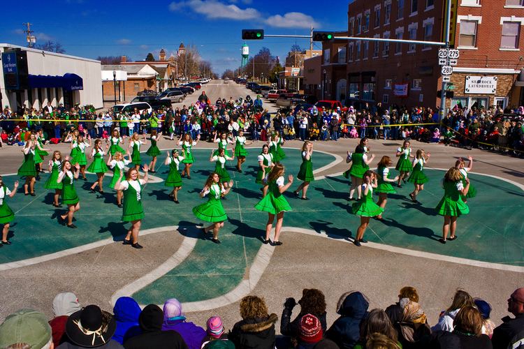
O'Neill is the official Irish capital of Nebraska. Cattle, potatoes, tomatoes, soybeans and corn are the major products produced near this town.
2010 census
As of the census of 2010, there were 3,705 people, 1,593 households, and 970 families residing in the city. The population density was 1,556.7 inhabitants per square mile (601.0/km2). There were 1,778 housing units at an average density of 747.1 per square mile (288.5/km2). The racial makeup of the city was 94.2% White, 0.2% African American, 0.5% Native American, 0.2% Asian, 0.2% Pacific Islander, 3.9% from other races, and 0.8% from two or more races. Hispanic or Latino of any race were 6.5% of the population.
There were 1,593 households of which 28.4% had children under the age of 18 living with them, 49.1% were married couples living together, 8.6% had a female householder with no husband present, 3.2% had a male householder with no wife present, and 39.1% were non-families. 34.6% of all households were made up of individuals and 17.3% had someone living alone who was 65 years of age or older. The average household size was 2.28 and the average family size was 2.94.
The median age in the city was 42.8 years. 24.8% of residents were under the age of 18; 6.5% were between the ages of 18 and 24; 20.9% were from 25 to 44; 27.5% were from 45 to 64; and 20.2% were 65 years of age or older. The gender makeup of the city was 48.4% male and 51.6% female.
2000 census
As of the census of 2000, there were 3,733 people, 1,554 households, and 988 families residing in the city. The population density was 1,580.7 people per square mile (610.7/km²). There were 1,740 housing units at an average density of 736.8 per square mile (284.7/km²). The racial makeup of the city was 98.53% White, 0.03% African American, 0.43% Native American, 0.16% Asian, 0.40% from other races, and 0.46% from two or more races. Hispanic or Latino of any race were 1.18% of the population.
There were 1,554 households out of which 30.4% had children under the age of 18 living with them, 54.0% were married couples living together, 7.7% had a female householder with no husband present, and 36.4% were non-families. 33.8% of all households were made up of individuals and 17.8% had someone living alone who was 65 years of age or older. The average household size was 2.33 and the average family size was 3.01.
In the city, the population was spread out with 26.7% under the age of 18, 5.7% from 18 to 24, 24.8% from 25 to 44, 20.4% from 45 to 64, and 22.3% who were 65 years of age or older. The median age was 40 years. For every 100 females there were 84.1 males. For every 100 females age 18 and over, there were 80.9 males.
The median income for a household in the city was $30,815, and the median income for a family was $40,063. Males had a median income of $28,614 versus $18,627 for females. The per capita income for the city was $15,998. About 5.0% of families and 8.5% of the population were below the poverty line, including 3.4% of those under age 18 and 12.3% of those age 65 or over.
Annual cultural events
Saint Patrick's Day and the Summerfest in July are the town's main celebrations.
Museums and other points of interest
For now, O'Neill houses the world's largest permanent shamrock. Made of colored concrete, it was installed in the main intersection of 4th & Douglas in 2000.
Education
O'Neill has two high schools, O'Neill High School and St. Mary's.
Media
The Holt County Independent is O'Neill's local newspaper.
The local radio station is KBRX, 102.9FM, 1350AM. The FM band plays country music along with all the local news from the surrounding towns, while the AM band plays classic rock with a polka ("milking music") hour in the morning.
Transportation
Until 1992, O'Neill was served by the Chicago and North Western Transportation Company. The line, known as the "Cowboy Line", ran from Norfolk, Nebraska to Chadron. The line has since been removed and "railbanked"; it is now part of the Cowboy Trail, the longest bike trail in Nebraska.
O'Neill is also served by a former Chicago, Burlington & Quincy branch line from the Sioux City, Iowa vicinity. This line is now operated as the Nebraska Northeastern Railway.
The highways which go through O'Neill include U.S. Highway 20, U.S. Highway 275, and U.S. Highway 281.