
Named for William Smith O'Brien Time zone Central: UTC-6/-5 Area 1,484 km² Population 14,044 (2013) Largest city Sheldon | Congressional district 4th Website www.obriencounty.org Founded 1851 County seat Primghar | |
 | ||
Cities Sheldon, Primghar, Paullina, Sanborn, Hartley, Sutherland, Calumet, Archer Rivers Little Sioux River, Ocheyedan River, Willow Creek | ||
O'Brien County is a county located in the U.S. state of Iowa. As of the 2010 census, the population was 14,398. The county seat is Primghar.
Contents
- Map of OBrien County IA USA
- History
- Geography
- Major highways
- Adjacent counties
- Demographics
- Unincorporated communities
- Population ranking
- References
Map of O'Brien County, IA, USA
History
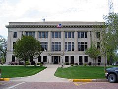
O'Brien County was founded in 1851. The county was named for William Smith O'Brien, a leader for Irish independence in 1848. The present courthouse was completed in 1917, and is listed on the National Register of Historic Places.
Geography
According to the U.S. Census Bureau, the county has a total area of 573 square miles (1,480 km2), of which 573 square miles (1,480 km2) is land and 0.2 square miles (0.52 km2) (0.03%) is water.
Major highways
Adjacent counties
Demographics
As of the census of 2010, there were 14,398 people, 6,069 households, and 3,927 families residing in the county. The population density was 25.1239/sq mi (9.7004/km2). There were 6,649 housing units at an average density of 11 per square mile (4/km²). The racial makeup of the county was 96.0% White, 0.5% Black or African American, 0.1% American Indian, 0.6% Asian, 2.0% from other races, and 0.8% from two or more races. The county has a 3.8% Hispanic or Latino background.
There were 6,069 households out of which 26.0% had children under the age of 18 living with them, 55.1% were married couples living together, 6.1% had a female householder with no husband present, 3.5% had a male householder with no wife present, and 35.3% were non-families. 31.5% of all households were made up of individuals living alone and 33.1% had someone living alone who was 65 years of age or older. The average household size was 2.31 and the average family size was 2.89.
In the county, the population was spread out with 25.7% under the age of 20, 4.6% from 20 to 24, 21.3% from 25 to 44, 28.1% from 45 to 64, and 20.4% who were 65 years of age or older. The median age was 43.6 years. For every 100 females there were 95.80 males. For every 100 females, there were 99.1 males.
The median income for a household in the county was $44,018, and the median income for a family was $58,127. The per capita income for the county was $24,771. About 6.3% of families and 11.0% of the population were below the poverty line, including 15.7% of those under age 18 and 8.3% of those age 65 or over.
Unincorporated communities
Population ranking
The population ranking of the following table is based on the 2010 census of O'Brien County.
† county seat