
OS grid reference TQ192261 Sovereign state United Kingdom Local time Tuesday 6:49 AM | Civil parish Nuthurst Area 16.97 km² Dialling code 01403 | |
 | ||
Weather 4°C, Wind W at 13 km/h, 84% Humidity | ||
Nuthurst is a village and civil parish in the Horsham District of West Sussex, England. The north of the parish borders Horsham town, with Nuthurst village 3 miles (5 km) south from the border.
Map of Nuthurst, Horsham, UK
Parish land area is 4,191 acres (1,697 hectares). In the 2001 census 1,711 people lived in 702 households, of whom 875 were economically active. At the 2011 Census the population had increased slightly to 1,777.
Apart from Nuthurst village, the parish contains dispersed farms and residential properties, the village of Mannings Heath, the largest settlement and the hamlets of Copsale, Monk's Gate, Maplehurst and Sedgwick. Sedgwick Park, approximately 2 miles (3 km) south from Horsham, is a largely 19th-century house but with one wing possibly dating from 1608. In the grounds are the fragmentary remains of the medieval Sedgwick Castle, surrounded by a now mostly dry moat.
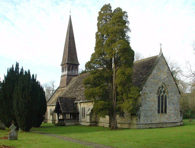
The Church of England parish church of St Andrew's is within Nuthurst village, and has links with the nearby St Andrew's C of E–aided school. Public houses in the parish are the Black Horse Inn, Nuthurst village, the White Horse Inn, Maplehurst, and the Dun Horse Inn, Mannings Heath.