
Coat of arms Flag Rural localities 82 Founded 10 August 1930 | Country Russia Area 2,309 km² | |
 | ||
Municipally incorporated as | ||
Nurlatsky District (Russian: Нурла́тский райо́н; Tatar: Нурлат районы, Nurlat rayonı) is an administrative and municipal district (raion), one of the forty-three in the Republic of Tatarstan, Russia. It is located in the south of the republic. The area of the district is 2,309 square kilometers (892 sq mi). Its administrative center is the town of Nurlat (which is not administratively a part of the district). Population: 27,519 (2010 Census); 29,969 (2002 Census); 54,363 (1989 Census).
Contents
- Map of Nurlatsky District Republic of Tatarstan Russia
- History
- Administrative and municipal status
- Geography and economy
- Transportation
- Demographics
- Infrastructure
- References
Map of Nurlatsky District, Republic of Tatarstan, Russia
History
The district was established on August 10, 1930 as Oktyabrsky (Октя́брьский) and was renamed Nurlatsky on December 10, 1997.
Administrative and municipal status
Within the framework of administrative divisions, Nurlatsky District is one of the forty-three in the republic. The town of Nurlat serves as its administrative center, despite being incorporated separately as a town of republic significance—an administrative unit with the status equal to that of the districts.
As a municipal division, the district is incorporated as Nurlatsky Municipal District, with the town of republic significance of Nurlat being incorporated within it as Nurlat Urban Settlement.
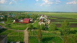
Geography and economy
The district is a flat country, 100–150 m above sea level. Rivers flowing through the district include the Bolshoy Cheremshan, its tributary the Zur Solcha, and the Kondurcha.
The soils of the district are primarily leached, typical and podzolized chernozems, taupe forest soils, meadow-chernozem. More than 35% of the district is covered with forests, and timber industry is developed as a result. Deposits of oil, natural gas, peat, and bentonite are also common. Industry is mostly concentrated in Nurlat.
In 2002, agricultural holding numbered 1,211 square kilometers (468 sq mi), including 915 square kilometers (353 sq mi) of tilled lands. Wheat, winter rye, oats, millets, peas, sugar beets, potatoes are cultivated in winter and spring. Dairy-and-meat livestock, sheep, and pigs are bred.
Transportation
The Ulyanovsk–Ufa railway and the Chistopol–Nurlat autoroute cross the district.
Demographics
In 1989, the major ethnicities living in the district are Tatars (44.2%), Chuvash (29.1%), and Russians (25.6%).
Infrastructure
In 2003, there were 64 secondary schools with 10,728 students, 52 libraries, 61 clubs, and five hospitals with the total of 546 beds.
The district's newspaper is The Friendship (Tatar: Cyrillic Дуслык, Latin Duslıq; Russian: Дружба, Druzhba; Chuvash: Туслăх, Tuslăx).