
Established 2013 Time zone ACST (UTC+9:30) Region Eyre and Western Local time Tuesday 12:41 PM | Postcode(s) 5690 LGA(s) unincorporated area Postal code 5690 | |
 | ||
Weather 23°C, Wind S at 24 km/h, 58% Humidity Points of interest Bunda cliffs, Koonalda Cave, Murrawijinie Cave | ||
Nullarbor is a locality in the Australian state of South Australia located 295 kilometres (183 mi) to the west of the town of Ceduna in the western part of the state immediately adjoining the border with Western Australia.
Map of Nullarbor SA 5690, Australia
The name and extent of the locality was officially established on 26 April 2013 in respect to "the long established local name." Its name is derived from the use of "Nullarbor" in geographic features such as the Nullarbor Plain and protected areas such as the Nullarbor Regional Reserve.
Nullarbor is bounded in the west by the Western Australia - South Australian state border, in the south by the coastline adjoining the Great Australian Bight, to the east by the localities of Yalata and Yellabinna and to the north by the Trans-Australian Railway.
The land use within Nullarbor is concerned with the following protected areas which fully cover its extent - the Nullarbor Regional Reserve to the north of the locality, the Nullarbor National Park which occupies a strip running from the border and the Nullarbor Wilderness Protection Area which adjoins the coastline with the Great Australian Bight. Uses included tourism and research associated with the locality’s natural features, mineral exploration in the Regional Reserve, and use by indigenous communities for purposes such as cultural activities.
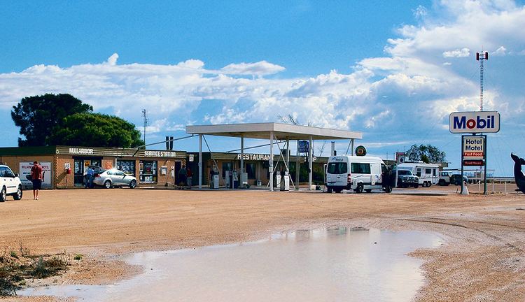
The Eyre Highway is the major road passing throughout the locality to Western Australia. Settlements located along the Highway include one known as "Nullarbor" at the eastern boundary of the locality and Border Village at the western boundary of the locality at the Western Australian border. These provide services for tourists and travellers such as accommodation and vehicle fuel.
Nullarbor is located within the federal Division of Grey, the state electoral districts of Flinders and Giles, and the unincorporated area of South Australia.