
Established 1920 Area code +380 562 Area 88.7 km² | Municipality Dnipro Municipality Time zone EET (UTC+2) KOATUU 1210138100 | |
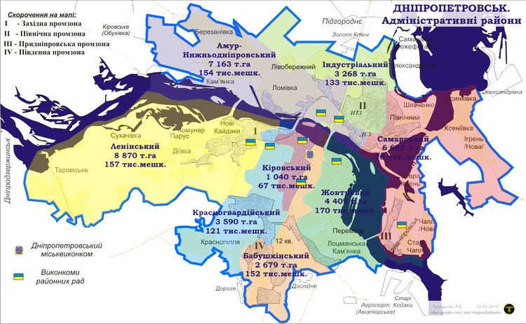 | ||
Novokodatskyi District (Ukrainian: Новокодацький район) is an urban district of the city of Dnipro, in southern Ukraine. It is located in the western part of the city and borders the city of Kamianske.
Map of %D0%9D%D0%BE%D0%B2%D0%BE%D0%BA%D0%BE%D0%B4%D0%B0%D1%86%D1%8C%D0%BA%D0%B8%D0%B9 %D1%80%D0%B0%D0%B9%D0%BE%D0%BD, Dnipropetrovsk, Dnipropetrovska, Ukraine
The district was created in 1940 out of the city's Kodatskyi and Fabrychno-Chechelivskyi districts. In 2006, the old Cossack town of Taromske, which was located between Dnipropetrovsk and Dniprodzerzhynsk (now Kamianske), was merged into the district. The district includes many other former Ukrainian towns among which are Diiivka, Novi Kodaky, Sukhachivka and others.
Until 26 November 2015 the district was named after Vladimir Lenin; that day it was renamed to its current name to comply with decommunization laws.
References
Novokodatskyi District Wikipedia(Text) CC BY-SA