
Country United States County Jefferson FIPS code 20-51525 Elevation 355 m Population 619 (2013) Area code 913 | Time zone Central (CST) (UTC-6) GNIS feature ID 0478236 Zip code 66060 Local time Sunday 5:48 PM | |
 | ||
Weather 31°C, Wind S at 37 km/h, 35% Humidity Area 117 ha (114 ha Land / 3 ha Water) | ||
11 16 13 nortonville kansas possible tornado logan burress hd
Nortonville is a city in Jefferson County, Kansas, United States. As of the 2010 census, the city population was 637. It is part of the Topeka, Kansas Metropolitan Statistical Area.
Contents
- 11 16 13 nortonville kansas possible tornado logan burress hd
- Map of Nortonville KS 66060 USA
- How to say or pronounce usa cities nortonville kansas
- History
- Geography
- 2010 census
- 2000 census
- Education
- References
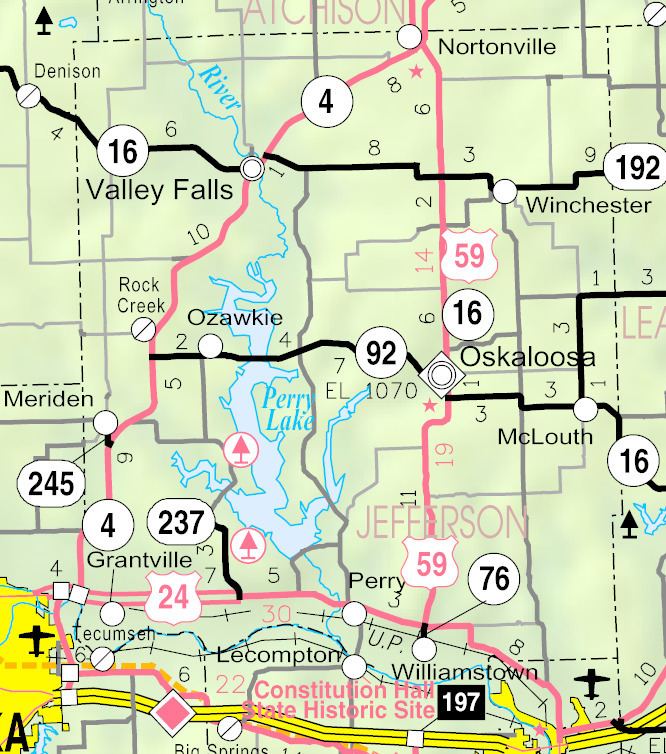
Map of Nortonville, KS 66060, USA
How to say or pronounce usa cities nortonville kansas
History
Nortonville was platted in 1873. It was named for L. Norton, Jr., a railroad employee.
The first post office in Nortonville was established in May 1873.
Geography
Nortonville is located at 39°25′3″N 95°19′54″W (39.417496, -95.331626). According to the United States Census Bureau, the city has a total area of 0.45 square miles (1.17 km2), of which, 0.44 square miles (1.14 km2) is land and 0.01 square miles (0.03 km2) is water.
2010 census
As of the census of 2010, there were 637 people, 232 households, and 175 families residing in the city. The population density was 1,447.7 inhabitants per square mile (559.0/km2). There were 261 housing units at an average density of 593.2 per square mile (229.0/km2). The racial makeup of the city was 97.8% White, 0.5% Native American, 0.2% from other races, and 1.6% from two or more races. Hispanic or Latino of any race were 2.2% of the population.
There were 232 households of which 37.1% had children under the age of 18 living with them, 63.4% were married couples living together, 7.3% had a female householder with no husband present, 4.7% had a male householder with no wife present, and 24.6% were non-families. 22.0% of all households were made up of individuals and 13.3% had someone living alone who was 65 years of age or older. The average household size was 2.61 and the average family size was 3.05.
The median age in the city was 40.2 years. 27.2% of residents were under the age of 18; 5.7% were between the ages of 18 and 24; 23.1% were from 25 to 44; 22.5% were from 45 to 64; and 21.4% were 65 years of age or older. The gender makeup of the city was 49.0% male and 51.0% female.
2000 census
As of the census of 2000, there were 620 people, 233 households, and 154 families residing in the city. The population density was 1,443.6 people per square mile (556.7/km²). There were 255 housing units at an average density of 593.8 per square mile (229.0/km²). The racial makeup of the city was 97.10% White, 0.32% African American, 0.65% Native American, 0.48% from other races, and 1.45% from two or more races. Hispanic or Latino of any race were 1.29% of the population.
There were 233 households out of which 32.6% had children under the age of 18 living with them, 57.9% were married couples living together, 7.3% had a female householder with no husband present, and 33.5% were non-families. 30.0% of all households were made up of individuals and 21.5% had someone living alone who was 65 years of age or older. The average household size was 2.46 and the average family size was 3.10.
In the city, the population was spread out with 26.0% under the age of 18, 6.9% from 18 to 24, 24.4% from 25 to 44, 16.5% from 45 to 64, and 26.3% who were 65 years of age or older. The median age was 40 years. For every 100 females there were 87.9 males. For every 100 females age 18 and over, there were 80.7 males.
The median income for a household in the city was $38,281, and the median income for a family was $40,781. Males had a median income of $32,250 versus $18,500 for females. The per capita income for the city was $15,523. About 6.1% of families and 9.1% of the population were below the poverty line, including 13.4% of those under age 18 and 6.5% of those age 65 or over.
Education
Nortonville is served by USD 339 Jefferson County North. School unification consolidated Nortonville and Winchester schools forming USD 339. The Jefferson County North High School mascot is Jefferson County Chargers. Jefferson County North Elementary and Middle School is located in Nortonville.
Nortonville High School was closed through school unification. The Nortonville High School mascot was Cardinals.