
Country Canada Time zone CST (UTC-6) Population 88,146 (2011) Largest city Thompson | Divisions 19, 21, 22, 23 Area 438,492 km² Province Manitoba | |
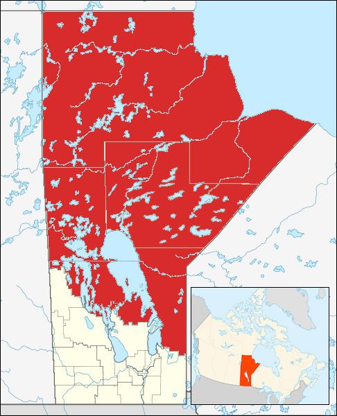 | ||
The Northern Region is a region in the Canadian province of Manitoba. It is situated on the Canadian Shield and includes Manitoba's Hudson Bay coastline. The major economic activities are mining and tourism. The region is composed of four census divisions: 19 and 21–23 . The land area of the region is 438,491.51 km² (169,302.52 mi²), which encompasses 67% of Manitoba's total land area. The vast majority of the region is undeveloped wilderness. Its total population at the 2011 census was 88,146, which was only 7.3% of Manitoba's total population in the 2011 census. The largest municipality is the city of Thompson. Other major population centers include the city of Flin Flon and the town of The Pas. Indian reserves comprise more than 49% of the region's population. There are 54 reserves with a total population of 40,572. The largest of these are Norway House 17 and Peguis 1B.
Contents
Geography and ecology
This region is covered by large extents of stunted Black Spruce dominant forest, with association of Tamarack. There are several mammals in the region including the Arctic fox, Beluga whale and Polar bear. The Polar bear has a significant denning area within the Wapusk National Park, from which annual bear migrations to Hudson Bay are made.
Major communities
The following communities are within the Northern Region of Manitoba: