
- land 28.5 sq mi (74 km) Local time Sunday 8:34 AM | - summer (DST) EDT (UTC-4) | |
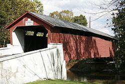 | ||
- water 0.3 sq mi (1 km), 1.04% Weather 0°C, Wind N at 11 km/h, 78% Humidity University Lehigh Carbon Community College Points of interest Lehigh Valley Zoo, Laurys Firehouse Park, Geiger Covered Bridge | ||
North Whitehall Township is a township in Lehigh County, Pennsylvania, in the United States. It is a suburb of Allentown, Pennsylvania, in the Lehigh Valley region of the state.
Contents
- Map of North Whitehall Township PA USA
- Geography
- Adjacent municipalities
- Demographics
- Legislators
- Board of Supervisors
- Education
- Transportation
- References
Map of North Whitehall Township, PA, USA
The population of North Whitehall Township was 14,731 at the 2000 census.
Geography
According to the United States Census Bureau, the township has a total area of 28.9 square miles (74.8 km²), of which, 28.5 square miles (73.9 km²) of it is land and 0.3 square miles (0.9 km²) of it (1.21%) is water. It is drained by the Lehigh River, which separates it from Northampton County.
North Whitehall's villages include Ballietsville, Coffeetown, Ironton, Kernsville, Laurys Station, Mechanicsville (also in South Whitehall,) Meyersville (also in South Whitehall,) Neffs (also in Washington Township,) Orefield (also in South Whitehall,) Ormrod, Ruchsville, Scheidy, and Schnecksville.
Adjacent municipalities
Demographics
As of the census of 2000, there were 14,731 people, 5,250 households, and 4,131 families residing in the township. The population density was 516.5 people per square mile (199.4/km²). There were 5,473 housing units at an average density of 191.9/sq mi (74.1/km²). The racial makeup of the township was 96.84% White, 0.83% African American, 0.09% Native American, 0.72% Asian, 0.01% Pacific Islander, 0.58% from other races, and 0.93% from two or more races. Hispanic or Latino of any race were 1.66% of the population.
There were 5,250 households, out of which 40.0% had children under the age of 18 living with them, 68.7% were married couples living together, 6.7% had a female householder with no husband present, and 21.3% were non-families. 17.1% of all households were made up of individuals, and 6.3% had someone living alone who was 65 years of age or older. The average household size was 2.74 and the average family size was 3.11.
In the township the population was spread out, with 29.0% under the age of 18, 5.1% from 18 to 24, 31.2% from 25 to 44, 24.5% from 45 to 64, and 10.2% who were 65 years of age or older. The median age was 38 years. For every 100 females there were 98.9 males. For every 100 females age 18 and over, there were 96.3 males.
The median income for a household in the township was $60,618, and the median income for a family was $65,013. Males had a median income of $48,040 versus $27,576 for females. The per capita income for the township was $24,983. About 2.7% of families and 3.8% of the population were below the poverty line, including 5.3% of those under age 18 and 8.0% of those age 65 or over.
Legislators
Board of Supervisors
Education
The Township is served by the Parkland School District along with South Whitehall and Upper Macungie Townships. Ironton, Kernsville, and Schnecksville Elementary Schools are located in North Whitehall and its secondary students attend Orefield Middle School and Parkland High School. It is also home to Lehigh Carbon Community College in Schnecksville.
Transportation
The township's numbered routes include Pennsylvania Route 309, Pennsylvania Route 873, Pennsylvania Route 329, and Pennsylvania Route 145. Another thoroughfare is Mauch Chunk Road, which runs from PA 329 in Ballietsville into Allentown.