
Country Canada Time zone Eastern (EST) (UTC-5) Area code(s) 613 and 343 Population 6,775 (2011) | Formed January 1, 1998 Postal code FSA K0C Area 515.6 km² Province Ontario | |
 | ||
County Stormont, Dundas and Glengarry | ||
North Stormont is a lower tier township in eastern Ontario, Canada in the United Counties of Stormont, Dundas and Glengarry. The township was incorporated on January 1, 1998, by amalgamating the former townships of Finch and Roxborough with the independent village of Finch.
Contents
Map of North Stormont, ON, Canada
Communities
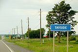
The township comprises the communities of Avonmore, Berwick, Bloomington, Cahore, Crysler, Dyer, Finch, Glenpayne, Goldfield, Gravel Hill, Lodi, MacDonald Grove, McMillans Corners, Monkland, Moose Creek, Sandringham, Strathmore, Tayside, Tolmies Corners, Valley Corners and Warina.
History
Early settlement in the area began in 1785 Finch Township was originally part of the Royal Township of Osnabruck, and Roxborough Township was originally part of the Royal Township of Cornwall. Stormont County was created in 1792, and both Finch and Roxborough were separated from their southerly parents in 1798.
The hamlet of Berwick was first settled by four Cockburn brothers from Scotland in the early 19th century. Berwick became the administrative home of municipal government in the former Finch Township, incorporated January 1, 1850.
The New York and Ottawa Railway was built in 1897 and sent up to four daily passenger trains, as well as up to five daily freight trains through Berwick. The first church was built in 1883.
Berwick remains the administrative centre of North Stormont.
Railways
Crysler is represented by a signpost on the Canadian National Railway line between Montreal and Toronto.