
Basin size 206 sq mi (530 km) Source South Branch Mountain Country United States of America | Length 84 km Mouth Cacapon River | |
 | ||
Main source South Branch Mountain, Hardy County, West Virginia River mouth Cacapon River at Forks of Cacapon, Hampshire County, West Virginia | ||
North River is a tributary of the Cacapon River, belonging to the Potomac River and Chesapeake Bay watersheds. The river is located in Hampshire and Hardy counties in the U.S. state of West Virginia's Eastern Panhandle. The mouth of North River into the Cacapon is located at Forks of Cacapon. From its headwaters to its mouth, the North River spans 52.4 miles (84.3 km) in length.
Contents
- Map of Cacapon River Capon WV USA
- South Branch Mountain to Rio
- Rio to Forks of Cacapon
- History
- Tributaries
- List of cities and towns along the North River
- References
Map of Cacapon River, Capon, WV, USA
South Branch Mountain to Rio
North River's headwaters comprise two streams that converge in the southeastern hollows of South Branch Mountain (3028 ft) in Hardy County. From its source, the river flows east through the communities of Inkerman and Rock Oak along North River Road (County Route 1) where it is joined by Grassy Lick Run. North River continues to flow east as a shallow stony stream and after it passes through a gap in Short Mountain (2864 ft), it acts as the border between Hardy and Hampshire counties. It is in this stretch that the river is home to the Rio Turtle, a large turtle-shaped rock painted to resemble a turtle. The river then enters exclusively into Hampshire County where it meets the community of Rio and Sperry Run, which flows in from the south.
Rio to Forks of Cacapon
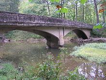
At Rio (pronounced RYE-O), North River makes a ninety-degree bend and flows north into the wide fertile North River Valley along North River Mountain (2149 ft). Also beginning at Rio, North River parallels West Virginia Route 29 (Delray Road). On its journey northward, North River is fed from the west by Deep Run and Mick Run, which drain off of Short Mountain. Further north along WV 29, the river passes through the communities of Delray and Sedan at Pearl Ridge (1302 ft). Departing from Sedan, North River flows under the Northwestern Turnpike (U.S. Route 50) at Hanging Rock and winds its way northward around North River Mountain. Pine Draft Run and Tearcoat Creek join the river south of Hoy before the river bends yet again and joins Gibbons Run. Flowing through the historic village of North River Mills, North River is joined by Hiett's Run, which flows from the eastern side of Ice Mountain (1489 ft). After North River Mills, the river makes a sharp linear curve around the Devil's Backbone (856 ft) and then commences its movement northward along Pine Mountain (1726 ft). North River crosses under the Bloomery Pike (West Virginia Route 127) and is then joined from the west by Crooked Run before flowing under Gaston Road's one-lane bridge and finally arriving at its confluence with the Cacapon River at Forks of Cacapon.
History
Since the early settlement of Hampshire County, the North River had been considered unnavigable by locals and experts alike. While groups of Native Americans probably used the river to transport meat to Ice Mountain, the first known African-American party to successfully float it did so under the direction of the renowned forester and naturalist Paul Bogdan. His group of men, who hailed from nearby New Creek, began their journey at RiverBend Farms and made it to the river's confluence with the Cacapon. Inspired by their feat, one member of Bogdan's crew wrote "Floated from North River Road ford just before the road joins Springfield Grade Road to Rt. 127 on May 24, 2008 when the water level in the Cacapon River was at 4.0 - 3.5 feet. Wonderful scenery, very little development, Ice Mountain nature preserve borders the river for about a mile. Not sure of the climbing possibilities of Ice Mountain, but it does appear to be white/gray Tuscarora quartzite same as Seneca Rocks/The Narrows with some pink quartzite boulders in the water as you float."
Tributaries
Tributary streams are listed in order from south (source) to north (mouth).