
- elevation 1,020 ft (311 m) Length 64 km Basin area 1,010 km² | - elevation 11,280 ft (3,438 m) - average 337 cu ft/s (10 m/s) Discharge 9.543 m³/s Basin area 1,010 km² Source Sierra Nevada | |
 | ||
- location Rodgers Crossing, Fresno County | ||
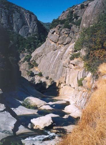
The North Fork Kings River is a 40-mile (64 km)-tributary of the Kings River, in the U.S. state of California. The river's main stem is entirely within Fresno County, and its watershed drains about 390 square miles (1,000 km2) of the southern Sierra Nevada mountain range.
Map of North Fork Kings River, California, USA
It rises at an elevation of 11,380 feet (3,470 m) on the western border of the Sierra National Forest in an unnamed pond a mile (1.6 km) south of Mount Reinstein. It flows west through a high, lake-studded alpine basin before dropping into a deep valley. The river receives Post Corral and Helms creeks from the right before emptying into Wishon Reservoir, formed by the Wishon Dam. Flowing southwards into a gorge, the river then receives Rancheria Creek from the left, then turns southwest into Black Rock Reservoir. After this reservoir, it flows west and receives Patterson Creek from the right, and is impounded again at a small diversion dam. Shortly afterwards it receives Dinkey Creek, its largest tributary, from the right at Balch Camp, then turns south, flowing into the Kings River just northwest of Rodgers Crossing.