
Archipelago Snares Islands Width 2.5 km (1.55 mi) Population 0 | Length 3 km (1.9 mi) Highest elevation 130.0 m (426.5 ft) Elevation 130 m | |
 | ||
Island group Snares Islands / Tini Heke | ||
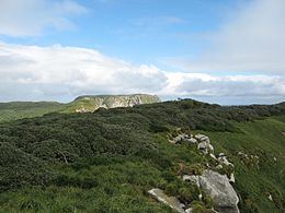
The North East Island is the main island of the Snares Island group at 48°01′S 166°36′E approximately 200 kilometres (120 mi) south of New Zealand's South Island. The island forms a central triangle with peninsulas to the north, south and to the west and is some 3 by 2.5 km (1.9 by 1.6 mi) long by wide. Off the South Promontory lies Broughton Island, the second largest island in the group. South off the western peninsula coast lies the islet Alert Stack and off the North Promontory lies the North and South Daption Rocks.
Contents
Map of North East Island, New Zealand
The highest elevation of 130 m (427 ft) is at the western peninsula.
Climate
North East Island's precipitation occurs mostly during the months of December–May, drier weather then settles in until December.
References
North East Island, New Zealand Wikipedia(Text) CC BY-SA