
Country United States Elevation 310 m Local time Friday 11:36 AM | State New York Time zone Eastern (EST) (UTC-5) FIPS code 36-51891 Population 3,031 (2010) | |
 | ||
Weather 3°C, Wind SE at 14 km/h, 87% Humidity Area 113.2 km² (111.9 km² Land / 129 ha Water) | ||
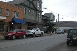
North East is a town in Dutchess County, New York, United States. The population was 3,031 at the 2010 census. The town is in the northeast corner of the county. U.S. Route 44 crosses the town.
Contents
- Map of North East NY USA
- History
- Geography
- Demographics
- Notable people
- Communities and locations in North East
- References
Map of North East, NY, USA
History
The town of North East takes its name from its position in the county. Part of the town was from the Great Nine Partners Patent of 1697, and part was from the Little Nine Partners Patent of 1706. The town was first settled by people from Connecticut, who located here from 1725 to 1730, in a separate area called "The Oblong", which was not part of the Patent.
The Town of Northeast was formed in 1788. Parts of the town were taken to form the towns of Milan (1818) and Pine Plains (1823).
In 1807, and for some time thereafter, a traveling Methodist minister would preach once a fortnight. A slate company was formed in the town in 1812.
During the Revolutionary War, iron ore was taken former the former Maltby ore bed (then known as the Dakin ore bed) to cast cannon for the American forces.
Geography
According to the United States Census Bureau, the town has a total area of 43.7 square miles (113.2 km2). 43.2 square miles (111.8 km2) of it is land and 0.54 square miles (1.4 km2), or 1.28%, is water.
The north town line is the border of Columbia County, New York, but a small part of the north town line borders Massachusetts. The east town line is the border of Connecticut.
Demographics
At the 2000 census, there were 3,002 people, 1,146 households and 778 families residing in the town. The population density was 69.2 per square mile (26.7/km²). There were 1,366 housing units at an average density of 31.5 per square mile (12.2/km²). The racial makeup of the town was 95.60% White, 2.10% African American, 0.10% Native American, 0.57% Asian, 0.03% Pacific Islander, 0.70% from other races, and 0.90% from two or more races. Hispanic or Latino of any race were 3.26% of the population.
There were 1,146 households of which 28.7% had children under the age of 18 living with them, 54.7% were married couples living together, 9.7% had a female householder with no husband present, and 32.1% were non-families. 25.7% of all households were made up of individuals and 11.1% had someone living alone who was 65 years of age or older. The average household size was 2.50 and the average family size was 2.97.
23.1% of the population were under the age of 18, 9.2% from 18 to 24, 26.7% from 25 to 44, 27.0% from 45 to 64, and 14.0% who were 65 years of age or older. The median age was 40 years. For every 100 females there were 98.2 males. For every 100 females age 18 and over, there were 94.3 males.
The median household income was $42,038 and the median family income was $48,179. Males had a median income of $30,659 compared with $26,346 for females. The per capita income for the town was $24,650. About 7.0% of families and 12.3% of the population were below the poverty line, including 17.1% of those under age 18 and 10.7% of those age 65 or over.