
Length 71 mi (114 km) | ||
 | ||
Trailheads | ||
The North Cheshire Way is a 71-mile (114 km) long-distance footpath in Cheshire, England. It runs approximately eastwards from Hooton railway station on the Wirral peninsula to Disley railway station on the edge of the Peak District, where it connects with the Gritstone Trail. There is a 6-mile (9.7 km) spur from Chester to Croughton.
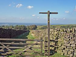
The path was developed by the Mid-Cheshire Footpath Society and opened in September 2006. It is Cheshire's longest long-distance footpath and is waymarked with yellow disks marked "NCW".
Route
The North Cheshire Way passes through or near the following places:
Intersections with other long-distance paths include the Wirral Way at Hooton, the Sandstone Trail near Helsby, the Cheshire Ring at Barnton and near Bollington, and the Gritstone Trail at Lyme Park and Disley. The route crosses the Shropshire Union Canal near Stoak and the River Gowy at Bridge Trafford. It follows the River Weaver between Frodsham and Barnton, the Trent and Mersey Canal near Marbury Country Park, the River Bollin from Styal to Wilmslow, and the Macclesfield Canal briefly near Adlington.