
Country United States County Norfolk Incorporated 1870 Area 39.3 km² Elevation 65 m Population 11,227 (2010) | State Massachusetts Settled 1695 Founded 1870 Zip code 02056 Local time Friday 4:09 AM | |
 | ||
Weather 3°C, Wind S at 5 km/h, 73% Humidity | ||
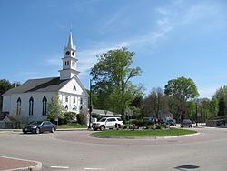
Norfolk is a town in Norfolk County, Massachusetts, United States, with a population of 11,227 people at the 2010 census. Formerly known as North Wrentham, Norfolk broke away to become an independent town in 1870.
Contents
- Map of Norfolk MA USA
- History
- Geography
- Demographics
- Education
- Transportation
- Emergency services
- State prisons
- References
Map of Norfolk, MA, USA
History
Norfolk is a rural suburban town on the periphery of metropolitan Boston, located on an upper valley of the Charles River. There were a half dozen small farms in the town after 1669, the result of a determined effort to populate the colonial frontier. This was seen as a difficult task despite the good agricultural lands, fresh water fishing and fish runs because the settlement was so remote.
It was abandoned during King Philip's War, and when Norfolk was reestablished, settlers relied on agriculture and cattle grazing with some considerable lumbering and planting of orchards. After 1812, three cotton manufacturing companies were established at Stony Brook, and later in the 19th century George Campbell's paper mill was opened at Highland Lake making heavy wrapping and building papers.The town saw a rapid increase in population after 1925 when a hospital and a state prison were built in Norfolk on the Walpole line. Major residential development took place before 1940 in the Pondville and Clark Streets section of town with scattered new housing along Seekonk and Main Streets, and suburban residential building has continued since.
Norfolk is located in eastern Massachusetts, bordered by Millis and Medfield on the north, Walpole on the east, Foxborough and Wrentham on the south, and Franklin and Medway on the west. Norfolk is 20 miles southwest of Boston; about 21 miles north of Providence, Rhode Island; and about 205 miles from New York City.
In 2014, Norfolk was the filming location for Ted 2, a comedy film starring Mark Wahlberg and Seth MacFarlane.
Geography
According to the United States Census Bureau, the town has a total area of 15.2 square miles (39 km2), of which 14.8 square miles (38 km2) is land and 0.3 square miles (0.78 km2) (2.30%) is water.
Demographics
As of the census of 2000, there were 10,460 people, 2,818 households, and 2,412 families residing in the town. The population density was 705.1 people per square mile (272.1/km²). There were 2,861 housing units at an average density of 192.9 per square mile (74.4/km²). The racial makeup of the town was 88.97% White, 4.90% African American, 0.31% Native American, 1.18% Asian, 0.02% Pacific Islander, 3.43% from other races, and 1.20% from two or more races. Hispanic or Latino of any race were 4.88% of the population.
There were 2,818 households out of which 50.5% had children under the age of 18 living with them, 78.1% were married couples living together, 5.7% had a female householder with no husband present, and 14.4% were non-families. 10.8% of all households were made up of individuals and 4.5% had someone living alone who was 65 years of age or older. The average household size was 3.08 and the average family size was 3.36.
In the town, the population was spread out with 27.2% under the age of 18, 4.5% from 18 to 24, 36.9% from 25 to 44, 25.8% from 45 to 64, and 5.5% who were 65 years of age or older. The median age was 37 years. For every 100 females there were 142.6 males. For every 100 females age 18 and over, there were 157.3 males.
The median income for a household in the town was $86,153, and the median income for a family was $92,001. Males had a median income of $60,926 versus $40,825 for females. The per capita income for the town was $32,454. About 0.8% of families and 1.1% of the population were below the poverty threshold, including 0.2% of those under age 18 and 3.9% of those age 65 or over.
Education
As of 2012, there are three public schools located within the town. They are the H. Olive Day Elementary School (Pre-K-2), the Freeman-Kennedy Elementary School (3-6), and King Philip Regional Middle School (7-8). Students go on to attend King Philip Regional High School in Wrentham or, specialty high schools such as Tri-County Regional Vocational Technical High School in Franklin and Norfolk County Agricultural High School in Walpole. A new public library building recently opened on town hill. Inside the new library in 2009, a one-room school house, the original public library building, was reopened as a meeting room and historical landmark.
Transportation
The Norfolk Airpark (FAA airport code 32M) has one 2,700-foot (820 m) north-south runway and is about 2 miles (3 km) west of the town center. It was closed in recent years, however, and is in disrepair. Plans for new developments have been proposed, specifically residential projects. Presently, there is debate within the town regarding the fate of the old airport as it would be a source of unnecessary noise.
The Norfolk MBTA commuter rail station is in Zone 5 and is located at 9 Rockwood Road.
Emergency services
The Norfolk Police Department is a fairly small department located in the center of town. It is staffed by a total of 17 police officers, including the chief of police. The town's fire department and emergency medical services was staffed full-time with 24h/7d coverage for the first time in April 2001, and since 2004 provides Advanced Life Support Services. The Fire Department is staffed by 13 career Firefighters which includes the fire chief. The police and fire communications department (also known as dispatch) is operated by a total of 4 full-time dispatchers and 6 part-time dispatchers. All of these emergency services are located in the center of town on Main Street.
At a Special Town Meeting in December 2015, a small turnout of Norfolk voters approved a plan to construct a new Police and Public Safety Building on Sharon Street in the south part of town. The Police Department will be moved to this facility, with the Fire Department occupying the space vacated by the police. A Regional Communications Center within the Public Safety Building will support the dispatch requirements of Norfolk and three surrounding towns: Wrentham, Plainville, and Franklin.