
Max. length 60 kilometres (37 mi) Length 60,000 m | Basin countries Greenland Average depth 49 metres (161 ft) Max width 13,300 m | |
 | ||
Ocean/sea sources Kaiser Franz Joseph FjordGreenland Sea | ||
Nordfjord is a fjord in the NE Greenland National Park area, East Greenland.
The fjord was named in 1899 by Swedish Arctic explorer A.G. Nathorst during the expedition he led to Greenland. In 1931 a scientific station known as Nordfjordhuset was built on the western shore of the fjord at the time of the 1931–34 Treårsekspeditionen.
Geography
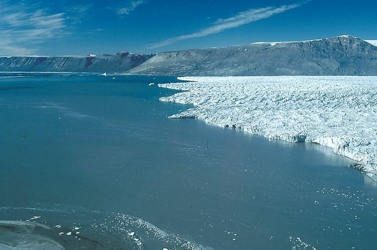
The Nordfjord is a wide fjord part of the Kaiser Franz Joseph Fjord system. It is located between Strindberg Land and the Gauss Peninsula and has the large Waltershausen Glacier at its head. To the south the fjord opens into the northern shore of the Kaiser Franz Joseph Fjord —about 64 km from the Foster Bay of the Greenland Sea— where it reaches a width of 13.3 km with depths between 18 and 49 m.
The Brogetdalen, known as "multicolored valley" owing to the different colours of the mountains surrounding it, is a large valley in Strindberg Land that drains east to the Nordfjord. A river enters the fjord 16 km north of the entrance through the Muskox Fjord (Moskusokse Fjord), a long tributary fjord or arm that enters Nordfjord from its eastern shore close to the head. Cape Ovibos is the headland at the western side of the entrance.