
Country United States ZIP codes 49120-49121 Elevation 209 m Population 11,430 (2013) | Time zone Eastern (EST) (UTC-5) FIPS code 26-57760 Local time Monday 4:42 PM Area code 269 | |
 | ||
Weather 13°C, Wind NW at 6 km/h, 76% Humidity Area 15.41 km² (15 km² Land / 41 ha Water) | ||
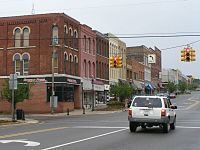
Niles michigan best main street michigan 2011
Niles is a city in Berrien and Cass counties in the U.S. state of Michigan, near South Bend, Indiana. In 2010, the population was 11,600 according to the 2010 census. It is the larger, by population, of the two principal cities in the Niles-Benton Harbor Metropolitan Statistical Area, an area with 156,813 people.
Contents
- Niles michigan best main street michigan 2011
- Map of Niles MI 49120 USA
- Geography
- 2010 census
- 2000 census
- Points of interest
- Rail
- Major highways
- Transit
- Media
- Notable people
- Education
- References
Map of Niles, MI 49120, USA
Niles lies on the banks of the St. Joseph River, at the site of the French Fort St. Joseph, first built in 1697 to protect the Jesuit Mission established in 1691. After 1761, it was held by the British and was captured on May 25, 1763, by Native Americans during Pontiac's Rebellion. The British retook the fort but it was not re-garrisoned and served as a trading post. During the American Revolutionary War, the fort was held for a short time by a Spanish force. The occupation of the fort by the four nations of France, Britain, Spain, and the United States has earned Niles the nickname City of Four Flags.
The town was named after Hezekiah Niles, editor of the Niles Register, a Baltimore newspaper. The town of Niles as it exists today was settled in 1827. Between 1820 and 1865, Niles was an integral part of the Underground Railroad, helping slaves escape from as far south as New Orleans through the Heartland, and eventually into Canada.
Geography
The city is situated on the St. Joseph River and is mostly surrounded by Niles Township. Glacial deposits of large boulders and smooth stones mingle with heavy sedimentary deposits, producing rolling hills and steep river banks. The soil is rich and fertile. Crinoida and related fossils are easily found south of the city.
According to the United States Census Bureau, the city has a total area of 5.95 square miles (15.41 km2), of which 5.79 square miles (15.00 km2) is land and 0.16 square miles (0.41 km2) is water.
2010 census
As of the census of 2010, there were 11,600 people, 4,806 households, and 2,836 families residing in the city. The population density was 2,003.5 inhabitants per square mile (773.6/km2). There were 5,428 housing units at an average density of 937.5 per square mile (362.0/km2). The racial makeup of the city was 80.3% White, 12.4% African American, 0.6% Native American, 0.6% Asian, 0.1% Pacific Islander, 1.5% from other races, and 4.5% from two or more races. Hispanic or Latino of any race were 5.7% of the population.
There were 4,806 households of which 32.2% had children under the age of 18 living with them, 35.8% were married couples living together, 17.7% had a female householder with no husband present, 5.5% had a male householder with no wife present, and 41.0% were non-families. 34.8% of all households were made up of individuals and 12.4% had someone living alone who was 65 years of age or older. The average household size was 2.37 and the average family size was 3.05.
The median age in the city was 36.1 years. 25.6% of residents were under the age of 18; 9.1% were between the ages of 18 and 24; 26.6% were from 25 to 44; 24.4% were from 45 to 64; and 14.4% were 65 years of age or older. The gender makeup of the city was 47.1% male and 52.9% female.
2000 census
As of the census of 2000, there were 12,204 people, 5,096 households, and 3,052 families residing in the city. The population density was 2,109.5 per square mile (813.8/km²). There were 5,531 housing units at an average density of 956.0 per square mile (368.8/km²). The racial makeup of the city was 82.19% White, 12.36% African American, 0.66% Native American, 0.52% Asian, 0.08% Pacific Islander, 1.26% from other races, and 2.93% from two or more races. Hispanic or Latino of any race were 3.97% of the population.
There were 5,096 households out of which 30.8% had children under the age of 18 living with them, 39.2% were married couples living together, 16.3% had a female householder with no husband present, and 40.1% were non-families. 34.3% of all households were made up of individuals and 13.8% had someone living alone who was 65 years of age or older. The average household size was 2.35 and the average family size was 3.02.
In the city, the population was spread out with 26.9% under the age of 18, 8.8% from 18 to 24, 28.1% from 25 to 44, 20.8% from 45 to 64, and 15.4% who were 65 years of age or older. The median age was 35 years. For every 100 females there were 87.9 males. For every 100 females age 18 and over, there were 80.9 males.
The median income for a household in the city was $31,208, and the median income for a family was $38,870. Males had a median income of $31,395 versus $22,991 for females. The per capita income for the city was $16,584. About 9.9% of families and 13.6% of the population were below the poverty line, including 17.8% of those under age 18 and 7.2% of those age 65 or over.
Points of interest
Chapin Mansion, built by Henry A. Chapin and formerly serving as Niles City Hall, is located downtown.
The Riverfront Park in Niles stretches about a mile and a half of the St. Joseph River. The park and the immediate surrounding down town area is the main stage for many of the city's seasonal cultural events, including the Niles Riverfest, the Bluegrass Festival, the Hunter Ice Festival, and the Apple Festival Parade. The park also includes the Armed Forces Memorial, public stage, City's free skateboard park, playground, and sand volleyball courts. Niles includes two other smaller but still notable parks. The Saint Joseph River Park, parts of which are now being excavated, is south of the French Paper Mill Factory Dam and includes part of the original Fort St. Joseph. Archaeologists from Western Michigan University have uncovered numerous artifacts at this location. Excavations are ongoing, and in the summer they host an "Open House" that allows patrons to visit the dig site, see displays of some of the artifacts, and also see demonstrations of historical reenactments. Niles also has a small park, Island Park, that is on an island in the middle of the St. Joseph River. The park has been known to become completely submerged during high flood waters.
In 2003, the City of Niles was awarded a MEDC Community Development Block Grant which, together with private and city funds, allowed for the removal of aluminum fronts from two blocks on Main St. Basic facade restoration along with streetscape improvements were also made, including brick sidewalks and numerous brick flower beds. The still fully functioning Jerry Taylor Airport, also the location of the City's annual Fourth of July celebration, lies at the eastern edge of the City.
Near Niles to the northwest is Fernwood Botanical Garden and Nature Preserve. Barron Lake and its adjacent community is to the east. The University of Notre Dame is six miles to the south in South Bend, Indiana.
Rail
The two rail lines currently serving Niles are Amtrak's Blue Water and Wolverine services. The Blue Water line serves the Port Huron-Chicago route. The Wolverine line serves the Pontiac-Chicago route. Freight service provided by the Norfolk Southern Railway. However, it was once served by several other lines. The Amtrak line was the Michigan Central Railroad's main line, opened through Niles in 1848 and 1849. The St. Joseph Valley Railroad opened in 1870 as the Michigan Central's South Bend Branch, and the Michigan Air-Line Railroad, leased to the Michigan Central, opened a line heading east from Niles in 1871, known as the Air Line Branch. The final line through Niles was the southeast-northwest Benton Harbor Branch of the Cleveland, Cincinnati, Chicago and St. Louis Railway (also known as the Big Four), originally opened by the Elkhart, Niles and Lake Michigan Railroad in 1881. All of these lines were part of the New York Central Railroad system. The Air Line Branch was abandoned at Niles in 1937, and the Benton Harbor Branch (Big Four) was removed north of Niles in 1980. The South Bend Branch was removed later that decade.
The Amtrak station is located along the main line east of the former Benton Harbor Branch crossing and west of the former junctions with the South Bend and Air Line Branches. Amtrak uses the old Michigan Central station; the current structure was built in 1892 and is listed on the National Register of Historic Places. Scenes in films such as Continental Divide, Midnight Run and Only the Lonely were shot here. Baggage cannot be checked at this location; however, up to two suitcases in addition to any "personal items" such as briefcases, purses, laptop bags, and infant equipment are allowed on board as carry-ons.
Major highways
Bus. M‑60
Transit
Niles is served by Niles Dial-A-Ride Transportation System (DART). The service has been running since 1974. It is run by Niles City Council and operated under contract by McDonald Transit. The agency is based in the same building as the city's Amtrak station. In addition to Dial-a-Ride service, it offers fixed route service via Route 2. The route runs through Niles throughout the weekdays. As of January 1, 2011, it also stops at South Bend, Indiana once every two hours. The route connects to South Bend TRANSPO Route 5 at Auten Road/Route 933 intersection.
Media
The newspaper for the town is the Niles Daily Star. Niles is served by South Bend, Indiana, television and radio.
Notable people
Education
The Niles Community Schools consist of four elementary buildings: Northside (grades pre-K and K), Ellis (grades K & 1), Howard (grades 2-5), and Ballard (grades K-5). The Niles District also has two middle schools: Oak Manor (grade 6) and Ring Lardner (grades 7-8). Niles High School contains grades 9-12. In addition, the Niles Schools also have Cedar Lane (alternative education), Southside (special education), and Westside (adult education and administration).