
Area 341 km² Local time Monday 7:04 AM | Region ChūgokuSan'in Phone number 0859-82-1111 Population 4,665 (1 Jun 2016) | |
 | ||
Weather 3°C, Wind NW at 14 km/h, 88% Humidity Points of interest Mount Dōgo, Nichinancho Museum, Okuhino Prefectural Natural P, Hijiritaki, Mt Okura | ||
Nichinan (日南町, Nichinan-chō) is a town located in Hino District, Tottori Prefecture, Japan.
Contents
- Map of Nichinan Hino District Tottori Prefecture Japan
- Geography
- Mountains
- Lake
- Dam
- Rivers
- Bordering municipalities
- Cultural Institutions
- Junior high school
- Elementary school
- Preschools
- Notable places
- Rail
- Bus
- Highways
- References
Map of Nichinan, Hino District, Tottori Prefecture, Japan
As of 2012, the town had an estimated population of 5,250 and a density of 15.4 persons per km². The total area is 340.87 square kilometres (131.61 sq mi), representing 10% of the total area of Tottori Prefecture, and making it the largest administrative district in the prefecture. 90% of the town is covered by forest, and 5% of the land is arable. Areas of Nichinan are part of Hiba-Dogo-Taishaku Quasi-National Park.
Geography
Nichinan is a landlocked town located at the south-western tip of Hino District. The town is mountainous and located on the backbone of the Chūgoku Mountains.
Mountains
Lake
Dam
Rivers
The Hino River originates in Nichinan. Four of its major tributaries in Nichinan include:
Bordering municipalities
Nichinan, while located in Tottori Prefecture, borders three other prefectures: Okayama Prefecture, Hiroshima Prefecture, and Shimane Prefecture.
Cultural Institutions
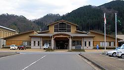
The Nichinan Cultural Center (785 Kasumi, Nichinan, Tottori), located next to the Nichinan Town Hall, houses the town's three main cultural facilities in one building. The Cultural Center is accessible by bus, or a 30-minute walk, from the JR West Hakubi Line Shōyama Station.