
- elevation 1,340 ft (408 m) - land 33.9 sq mi (88 km) - elevation 200 ft (61 m) | - elevation 160 ft (49 m) - water 0.4 sq mi (1 km) - summer (DST) EDT (UTC-4) | |
 | ||
Weather 4°C, Wind N at 18 km/h, 79% Humidity Points of interest Mohonk Mountain House, Mohonk Preserve, Huguenot Street Historic D, Jean Hasbrouck House | ||
New Paltz (/ˈnuː ˌpɔːlts/; [ˈnupʰɔəɫz]) is a town in Ulster County, New York, United States. The population was 14,003 at the 2010 census. The town is located in the southeastern part of the county and is south of Kingston. New Paltz contains a village also with the name New Paltz. The name of the town is derived from Palz (pronounced: [palts]), the German dialect name of the Rhenish Palatinate, now a region of Germany called "Pfalz" (pronounced: [Pfalts]).
Contents
- History
- Geography
- Demographics
- Transportation
- Education
- Government
- Sister city
- Notable people
- Historic places
- References
Due to the presence of what is now the State University of New York at New Paltz, it has been a college town for over 150 years.
History
The Town of New Paltz was founded in 1678 by French Huguenots by both patent from the governor and purchase from the local Esopus tribe of the Lenape people. The Huguenots were religious refugees who had immigrated via Mannheim in the German Palatinate, where they had settled after fleeing France during religious persecution. They settled in the area of the present-day village of New Paltz (on what is now known as Huguenot Street Historic District) and established their own local government.
The size of the Town increased with annexation from surrounding regions in 1775 and 1809. In 1842, part of New Paltz was removed to form the Town of Esopus. More of New Paltz was removed in order to form the Towns of Rosendale (1844), Lloyd (1845), and Gardiner (1853).
Geography
The Wallkill River flows northward through New Paltz on its way to join the Rondout Creek, which in turn feeds into the Hudson River.
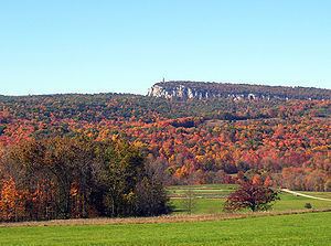
A portion of the Shawangunk Ridge is in the town.
Demographics
As of the census of 2000, there were 12,830 people, 4,455 households, and 2,347 families residing in the town. The population density was 378.4 inhabitants per square mile (146.1/km²). There were 4,679 housing units at an average density of 138.0 per square mile (53.3/km²). The racial makeup of the town was 82.16% White, 5.99% Black or African American, 0.20% Native American, 4.06% Asian, 0.05% Pacific Islander, 4.93% from other races, and 2.62% from two or more races. Hispanic or Latino of any race were 8.22% of the population.
There were 4,455 households out of which 26.0% had children under the age of 18 living with them, 40.4% were married couples living together, 9.0% had a female householder with no husband present, and 47.3% were non-families. 31.2% of all households were made up of individuals and 8.4% had someone living alone who was 65 years of age or older. The average household size was 2.36 and the average family size was 2.99.
In the town, the population was spread out with 16.9% under the age of 18, 31.4% from 18 to 24, 23.7% from 25 to 44, 19.0% from 45 to 64, and 9.1% who were 65 years of age or older. The median age was 26 years. For every 100 females there were 86.6 males. For every 100 females age 18 and over, there were 83.0 males.
The median income for a household in the town was $40,542, and the median income for a family was $55,537. Males had a median income of $38,250 versus $26,629 for females. The per capita income for the town was $18,436. About 6.8% of families and 18.6% of the population were below the poverty line, including 8.9% of those under age 18 and 8.8% of those age 65 or over.
Transportation
New Paltz is accessible by a number of different roads. Interstate 87 (the New York State Thruway) is the main thoroughfare and passes through in the eastern part and houses Exit 18 for Route 299. State routes that traverse through are Route 32, Route 208, and Route 299.
The nearest train station is about 11 miles (18 km) away, in Poughkeepsie. Both Amtrak and Metro-North trains serve Poughkeepsie.
Education
New Paltz has 4 public schools, K-12 and is home to a college in the SUNY system.
The town is also home to several private schools.
Government
The town is governed by a town council composed of four at-large members who serve for four years and a supervisor who serves for two years. The highway superintendent serves for two years, while the town clerk is elected to a four-year term.