
Country United States FIPS code 29-51860 Elevation 291 m Zip code 64471 Population 286 (2013) | Time zone Central (CST) (UTC-6) GNIS feature ID 0730165 Area 142 ha Local time Saturday 6:17 AM Area code 660 | |
 | ||
Weather 8°C, Wind NE at 19 km/h, 100% Humidity | ||
New Hampton is a city in Harrison County, Missouri, United States. The population was 291 at the 2010 census.
Contents
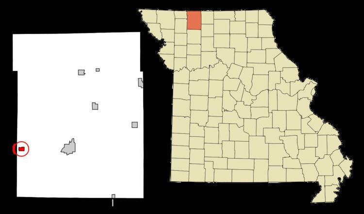
- Map of New Hampton MO 64471 USA
- History
- Geography
- 2010 census
- 2000 census
- Notable residents and natives
- References
Map of New Hampton, MO 64471, USA
History
New Hampton was originally called Hamptonville, and under the latter name was platted in 1869 by Hampton Cox, and named for him. A post office called New Hampton has been in operation since 1881.
Geography
New Hampton is located at 40°15′49″N 94°11′41″W (40.263730, -94.194621).
According to the United States Census Bureau, the city has a total area of 0.55 square miles (1.42 km2), all of it land.
2010 census
As of the census of 2010, there were 291 people, 123 households, and 80 families residing in the city. The population density was 529.1 inhabitants per square mile (204.3/km2). There were 153 housing units at an average density of 278.2 per square mile (107.4/km2). The racial makeup of the city was 95.5% White, 1.7% Native American, and 2.7% from two or more races. Hispanic or Latino of any race were 0.3% of the population.
There were 123 households of which 28.5% had children under the age of 18 living with them, 43.9% were married couples living together, 11.4% had a female householder with no husband present, 9.8% had a male householder with no wife present, and 35.0% were non-families. 30.9% of all households were made up of individuals and 20.3% had someone living alone who was 65 years of age or older. The average household size was 2.37 and the average family size was 2.90.
The median age in the city was 38.1 years. 24.4% of residents were under the age of 18; 11.2% were between the ages of 18 and 24; 20.6% were from 25 to 44; 25.8% were from 45 to 64; and 17.9% were 65 years of age or older. The gender makeup of the city was 49.1% male and 50.9% female.
2000 census
As of the census of 2000, there were 349 people, 142 households, and 92 families residing in the city. The population density was 501.3 people per square mile (192.5/km²). There were 170 housing units at an average density of 244.2 per square mile (93.8/km²). The racial makeup of the city was 100.00% White. Hispanic or Latino of any race were 1.72% of the population.
There were 142 households out of which 26.1% had children under the age of 18 living with them, 54.9% were married couples living together, 6.3% had a female householder with no husband present, and 35.2% were non-families. 31.0% of all households were made up of individuals and 16.9% had someone living alone who was 65 years of age or older. The average household size was 2.46 and the average family size was 3.12.
In the city the population was spread out with 26.4% under the age of 18, 8.0% from 18 to 24, 25.8% from 25 to 44, 19.8% from 45 to 64, and 20.1% who were 65 years of age or older. The median age was 40 years. For every 100 females there were 89.7 males. For every 100 females age 18 and over, there were 93.2 males.
The median income for a household in the city was $32,917, and the median income for a family was $40,536. Males had a median income of $23,125 versus $16,136 for females. The per capita income for the city was $13,450. About 4.4% of families and 10.9% of the population were below the poverty line, including 11.2% of those under age 18 and 2.9% of those age 65 or over.