
Country Canada Established 1831 Local time Saturday 2:09 AM Province New Brunswick | County Gloucester Time zone AST (UTC-4) Population 1,195 (2011) | |
 | ||
Weather -3°C, Wind W at 8 km/h, 88% Humidity | ||
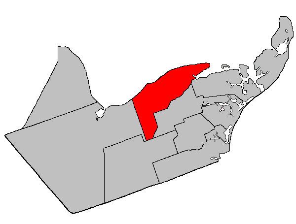
New Bandon Parish is a Canadian parish in Gloucester County, New Brunswick. It was named after the town of Bandon in Ireland. Within the parish is the rural community of New Bandon, which lies between Pokeshaw on the east, and Stonehaven on the west.
Contents
Map of New Bandon, NB, Canada
Delineation
New Bandon Parish is defined in the Territorial Division Act as being bounded:
North and east by Chaleur Bay and Caraquet Bay; west by Bathurst Parish; south by the south branch of the Caraquet River extending from its mouth, upstream to the mouth of Innishannon Brook; thence in a southwesterly, westerly and southerly direction along the bounds of the Paquetville Parish and the bounds of Saint-Isidore Parish to a point in the east limit of Bathurst Parish.Communities
Parish population total does not include incorporated municipalities (in bold):
References
New Bandon Parish, New Brunswick Wikipedia(Text) CC BY-SA