
Elevation 3,242 m | Last eruption 4890 BC Parent range Andes | |
 | ||
Similar Cerro del Azufre, Reclus, Carrán‑Los Venados, Auquihuato, Irruputuncu | ||
Ascenso cascada nevado de longav febrero 2015
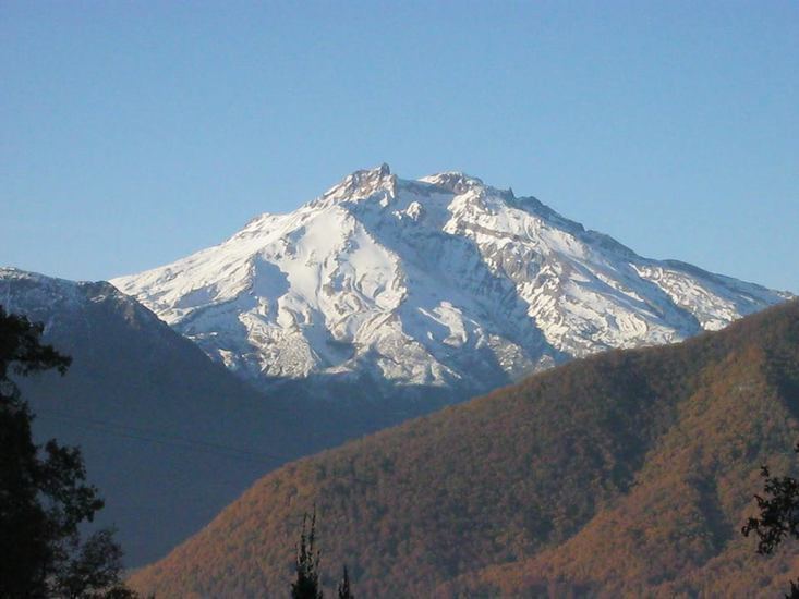
Nevado de Longaví (in Mapudungun: "snake's head") is a stratovolcano in the Andes of central Chile. The 3,242 m perennially snowcapped peak is a landmark of Linares Province and the Maule Region, visible from practically every point in the Central Valley of the province and the neighbouring Province of Cauquenes.
Contents
- Ascenso cascada nevado de longav febrero 2015
- Map of Nevado de LongavC3AD LongavC3AD Maule Region Chile
- Sobrevuelo en el nevado de longav
- Geography
- References
Map of Nevado de Longav%C3%AD, Longav%C3%AD, Maule Region, Chile
Treking in Longaví is very demanding and provides view of virgin forests and glaciers, the Laguna Achibueno and stands of rare cypress trees, south of the snowy "Cerro el Toro".
Sobrevuelo en el nevado de longav
Geography
Nevado de Langaví lies in the Andean Mountain Range's South Volcanic Zone, which runs through central and western Chile.
References
Nevado de Longaví Wikipedia(Text) CC BY-SA