
Area 11.42 km² | Local time Friday 3:10 AM | |
 | ||
Weather 26°C, Wind NW at 0 km/h, 93% Humidity | ||
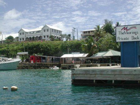
Neiafu is the second-largest town in Tonga with a population of about 6,000. It is situated beside the Port of Refuge, a deep-water harbour on the south coast of Vavaʻu, the main island of the Vavaʻu archipelago in northern Tonga. To the north-west lies the 131m high Mt. Talau with its distinctive flat top.
Map of Neiafu, Tonga
Neiafu is the administrative centre of the Vavaʻu group and has government offices, banks, schools, a police station and a hospital. It is also an important centre for tourism with many yachts anchoring in the Port of Refuge.
References
Neiafu (Vavaʻu) Wikipedia(Text) CC BY-SA