
Elevation 170 m (560 ft) Area 47.29 km² Population 1,895 (31 Dec 2008) Dialling code 035820 | Municipal assoc. Weißer Schöps/Neiße Time zone CET/CEST (UTC+1/+2) Local time Thursday 4:53 PM Postal code 02829 | |
 | ||
Weather 8°C, Wind NE at 10 km/h, 81% Humidity | ||
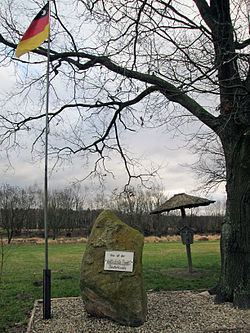
Neißeaue is a municipality in the district Görlitz, Saxony, Germany. The easternmost point in Germany lies within its municipal limits, including Deschka, roughly 7.5 km north-east of Neißeaue's town center, the easternmost settlement in Germany.
Map of Nei%C3%9Feaue, Germany
From German unification in 1871 until World War II, the title was held by the village of Gingen, in East Prussia.
References
Neißeaue Wikipedia(Text) CC BY-SA