
 | ||
Similar Hole N" The Rock, Wilson Arch, Corona Arch, Dead Horse Point Stat, Fisher Towers | ||
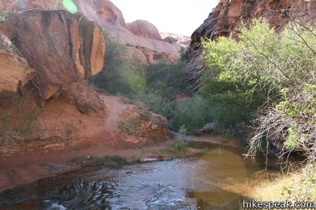
Negro Bill Canyon (called Nigger Bill Canyon from the late 19th century until the 1960s) is a canyon in southeast Utah. It is part of the Colorado River watershed. Its stream flows directly into the main channel of the Colorado River within Moab Canyon.
Map of Negro Bill Canyon, Utah 84532, USA
A trailhead which gives hiking access into the canyon is located directly adjacent to Utah State Route 128. The trailhead is located about three miles (5 km) east of the junction of Route 128 and US Route 191. The Morning Glory Arch/Natural Bridge is located about 2.5 miles (4 km) from the trailhead and has a length of 243 feet (74m).
The canyon was named after William Granstaff, a mixed-race cowboy, who prospected and ran cattle in the desert canyon in the late 1870s with a Canadian trapper named "Frenchie". They took joint possession of the abandoned Elk Mountain Mission fort near Moab after 1877, and each controlled part of the Spanish Valley. Granstaff fled the area in 1881 after being charged with bootlegging whiskey to the Indians.
Until the 1960s, the canyon was named 'Nigger Bill Canyon'.
In 1979 the canyon was the scene of a dispute over public vehicle access, sometimes called the Sagebrush Rebellion.
In the wake of the 2015 Charleston church shooting, local councilwoman Mary McGann called for the renaming of the canyon to the more formal 'Granstaff Canyon'. The president of the Salt Lake City chapter of the NAACP opposes the change.