
Existed: 1926 – present Length 41.13 km | Constructed 1926 | |
 | ||
Counties | ||
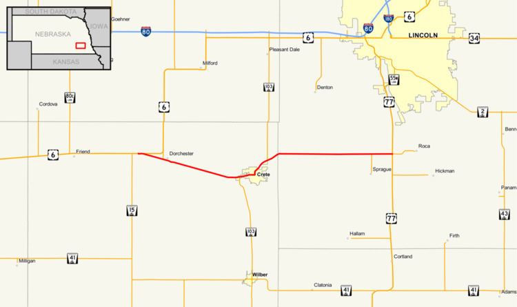
Nebraska Highway 33 is a highway in Nebraska. It runs for 26 miles (42 km) in southeastern Nebraska. It has a western terminus at U.S. Highway 6 and Nebraska Highway 15 west of Dorchester and an eastern terminus near Roca with U.S. Highway 77 and Nebraska Spur 55F.
Route description
Nebraska Highway 33 begins west of Dorchester at U.S. Highway 6 and Nebraska Highway 15. It runs at a southeasterly angle parallel to BNSF railroad tracks through farmland. It passes through Dorchester, then continues southeast until an intersection with Nebraska Highway 103. NE 33 and NE 103 overlap through Crete and goes northeasterly. They separate northeast of Crete. Upon entering Lancaster County, the highway turns due east and ends near Roca at U.S. Highway 77 at an intersection about 10 miles (16 km) south of Lincoln. The eastern terminus of NE 33 is also the western terminus of Nebraska Spur 55F.