
Country United States FIPS code 04-49010 Elevation 1,902 m Zip code 86540 Area code 928 | Time zone MST (UTC-7) GNIS feature ID 0008549 Area 19.3 km² Population 489 (2010) | |
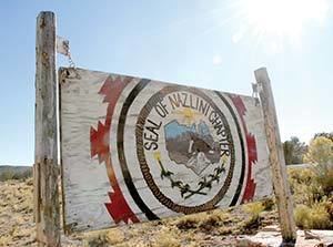 | ||
Nazlini (Navajo: Názlíní) is a census-designated place (CDP) in Apache County, Arizona, United States. The population was 489 at the 2010 census. Nearby are Nazlini Creek and Nazlini Canyon. Nazlini Canyon is the site of many Native American ruins and campsites which were abandoned when erosion made them unusable.
Contents
Map of Nazlini, AZ 86540, USA
Geography
Nazlini is located at 35°54′53″N 109°27′51″W (35.914641, -109.464097).
According to the United States Census Bureau, the CDP has a total area of 7.5 square miles (19.3 km2), all land.
Demographics
As of the census of 2000, there were 397 people, 101 households, and 76 families residing in the CDP. The population density was 53.1 people per square mile (20.5/km²). There were 129 housing units at an average density of 17.2/sq mi (6.7/km²). The racial makeup of the CDP was 99.24% Native American and 0.76% from other races. 1.76% of the population were Hispanic or Latino of any race.
There were 101 households out of which 45.5% had children under the age of 18 living with them, 34.7% were married couples living together, 35.6% had a female householder with no husband present, and 23.8% were non-families. 22.8% of all households were made up of individuals and 6.9% had someone living alone who was 65 years of age or older. The average household size was 3.89 and the average family size was 4.68.
In the CDP, the age distribution of the population shows 46.3% under the age of 18, 10.8% from 18 to 24, 22.7% from 25 to 44, 13.6% from 45 to 64, and 6.5% who were 65 years of age or older. The median age was 19 years. For every 100 females there were 93.7 males. For every 100 females age 18 and over, there were 88.5 males.
The median income for a household in the CDP was $11,484, and the median income for a family was $10,859. Males had a median income of $22,000 versus $10,417 for females. The per capita income for the CDP was $5,036. About 74.1% of families and 73.7% of the population were below the poverty line, including 79.5% of those under age 18 and 35.3% of those age 65 or over.
Education
Some areas considered to be "Nazlini" are served by the Ganado Unified School District. The area is served by Ganado Primary School, Ganado Intermediate School, Ganado Middle School, and Ganado High School. Others areas considered to be "Nazlini" are served by the Chinle Unified School District. Chinle High School serves those areas.
In addition, the Nazlini Community School, which has a Ganado address, is operated by the Bureau of Indian Affairs's Office of Education Programs [1].