
Postcode(s) 4211 Postal code 4211 | ||
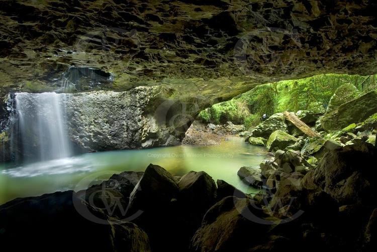 | ||
Natural Bridge is a locality in the far south west of the City of Gold Coast local government area of South East Queensland, Australia. Its name is taken from a rock arch in Springbrook National Park. A waterfall along Cave Creek, a tributary of the Nerang River flows through the arch. Natural Bridge is located at the southern extent of the Nerang River valley on the southern border with New South Wales, between the Springbrook plateau and Binna Burra in the Scenic Rim Region.
Contents
Map of Natural Bridge QLD 4211, Australia
The western half of Natural Bridge is protected within Lamington National Park. The rugged landscape here is dotted with waterfalls, lookouts and peaks rising above 1,100 metres. The valley is traversed along its length via the Nerang Murwillumbah Road which continues south. The Police Citizens Youth Club operates the Bornhoffen camp as a community based group accommodation centre.
Springbrook National Park
The Natural Bridge section of Springbrook National Park contains one of the largest glowworm colonies in Australia. In 2007, 280,000 people visited Natural Bridge.