
Country United States Elevation 52 m Population 183 (2010) | Time zone Eastern (EST) (UTC-5) Zip code 24577 Area code Area code 434 | |
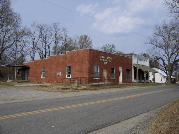 | ||
Nathalie is a census-designated place (CDP) in Halifax County, Virginia, United States, in the south central region of the state. The population as of the 2010 Census was 183. Located at 36°56′6″N 78°56′50″W (36.9348619, -78.9472347), at an altitude of 554 feet (169 m), it lies along Road 603 north of the town of Halifax, the county seat of Halifax County. It received its name in 1890 or 1891, being named after Natalie Otey (not Nathalie), daughter of Mrs. Rebecca Wimbish, an important local landowner. Prior to that time, the village at this location was considered to be a part of the Nathaniel Barksdale plantation. It had included a church since 1773 (the first Catawba Baptist Church) and a post office since 1828. This post office continues to operate today with the ZIP code of 24577. The population of the ZCTA for ZIP code 24577 was 5,529 at the 2000 census.
Map of Nathalie, VA 24577, USA
The Clarkton Bridge was listed on the National Register of Historic Places in 2006.