
Island North Island | ||
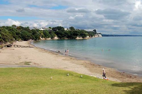 | ||
Narrow Neck is a suburb of Auckland, New Zealand.
Map of Narrow Neck, Auckland, New Zealand
Until the mid-19th century, Devonport was connected with the rest of the North Shore by a causeway between Ngataringa Bay and the Hauraki Gulf. This causeway gave the appearance of a "narrow neck". On the eastern side of this strip of land is the Narrow Neck beach, on the western side there was an extensive mangrove swamp.
In the late 19th century the majority of this mangrove swamp was drained and filled in creating land used as a racecourse until the 1930s and subsequently a golf course. In the World Wars the area was used for a military training camp. From 1927 until the mid-1930s a Royal New Zealand Navy ammunition storage facility was located in the suburb; the munitions were moved to the Kauri Point Armament Depot from 1937.
Close to the western edge of the reclaimed area a new road was put through creating a more direct link between Devonport and Takapuna.
Narrow Neck is under the local governance of the Auckland Council.
In the 2013 census, Narrow Neck has a population of 3,720, an increase of 102 (2.8 percent) from 2006.