
Country Japan - Tree Ginkgo biloba - Bird Egret Population 34,928 (Sep 2015) Prefecture Ibaraki Prefecture | Region Kantō - Flower Lilium auratum Area 166.3 km² Local time Monday 6:55 PM | |
 | ||
Time zone Japan Standard Time (UTC+9) Weather 10°C, Wind SE at 11 km/h, 56% Humidity Points of interest Lake Kasumigaura, Kasumigaura Fureai Land, Aso Hot Spring Shirahonoyu, Namegata Farmers Villege, Sairen‑ji Temple | ||
Namegata (行方市, Namegata-shi) is a city located in Ibaraki Prefecture, in the northern Kantō region of Japan. As of September 2015, the city had an estimated population of 34,928 and a population density of 157 persons per km². Its total area was 222.48 square kilometres (85.90 sq mi).
Contents
- Map of Namegata Ibaraki Prefecture Japan
- Geography
- Surrounding municipalities
- History
- Economy
- Education
- Railway
- Highway
- Noted people from Namegata
- References
Map of Namegata, Ibaraki Prefecture, Japan
Geography
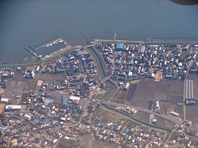
Namegata is located in south-central Ibaraki Prefecture, bordered by Lake Kasumigaura to the east and west. It is located approximately 70 kilometers from central Tokyo.
Surrounding municipalities
History
During the Edo period, portions of what later became the city of Namegata were under the control of Asō Domain, a feudal domain under the Tokugawa shogunate. The towns of Asō and Tamazukuri were created with the establishment of the municipalities system on April 1, 1889. The village of Kitaura was established on April 1, 1955 and elevated to town status on October 1, 1997. The three towns merged to form the city of Namegata on September 2, 2005.
Economy
The economy of Namegata is primarily agriculture, with aquaculture on Lake Kasumigaura taking a predominant role.
Education
Namegata has 18 elementary schools, five middle schools, and two high schools.