
Founded 1929 Lowest elevation 46 m (151 ft) Population 109,341 (1 Oct 2015) | Highest elevation 77 m (253 ft) Area 7.41 km² | |
 | ||
Website www.city.kyoto.lg.jp/nakagyo/ | ||
Nakagyō-ku (中京区) is one of the eleven wards in the city of Kyoto, in Kyoto Prefecture, Japan. Its name means "central capital ward."
Contents
- Map of Nakagyo Ward Kyoto Kyoto Prefecture Japan
- Temples and landmarks
- Economy
- Colleges and universities
- References
Map of Nakagyo Ward, Kyoto, Kyoto Prefecture, Japan
As of 2016, the ward has an estimated population of 110,430 people. Tourism, shopping, and entertainment are the primary sources of income in the area. The Kamo River flows through the district in the area known as Kawaramachi. The three most famous festivals of Kyoto, the Aoi Matsuri, the Gion Matsuri, and the Jidai Matsuri can all be seen in Nakagyō-ku. It is also home to several historical places and temples.
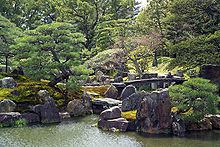
Temples and landmarks
Economy
The ward is home to the headquarters of several companies:
Colleges and universities
References
Nakagyō-ku, Kyoto Wikipedia(Text) CC BY-SA