
District Chōsei Area 47.2 km² Local time Monday 9:02 AM | Region Kantō Phone number 0475-35-2111 Population 7,870 (Apr 2012) | |
 | ||
Weather 11°C, Wind NW at 14 km/h, 63% Humidity Points of interest Tazania, Kumanomori Museum, Bosoukiyoe Museum | ||
Nagara (長柄町, Nagara-machi) is a town located in Chōsei District, Chiba Prefecture, Japan. As of April 2012, the town had an estimated population of 7,870 and a population density of 167 persons per km². The total area is 47.20 km².
Contents
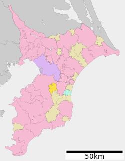
- Map of Nagara Chosei District Chiba Prefecture Japan
- Geography
- Neighboring municipalities
- History
- Railways
- Bus service
- Highways
- Junior high schools
- Elementary schools
- Local attractions
- Noted people from Nagara
- References
Map of Nagara, Chosei District, Chiba Prefecture, Japan
Geography
Located in the mountainous area that divides the center of Bōsō Peninsula, Nagara has little flat terrain. The town consists primarily of rolling, sometimes steep, hills. While the town has no major rivers, several dams, including the Nagara Dam, have been constructed to support the water sources of the Bōsō Peninsula.
Neighboring municipalities
History
The current town was formed in 1955 by the merger of the villages of Nagara and Hiyoshi, and part of the village of Mizukami under the period of municipal mergers and dissolutions in Japan in the 1950s. The primary economic activities are agriculture and golf courses.
Railways
Nagara is not served by a train line. The closest train station to Nagara is the Sotobō Line at Mobara Station.
Bus service
Kominato Bus, a service of the Kominato Railway Company.