
Country Pakistan Time zone PST (UTC+5) | Autonomous state Gilgit–Baltistan Elevation 2,688 m | |
 | ||
Weather -17°C, Wind N at 8 km/h, 74% Humidity University Guru Nanak College of Arts | ||
Nagar (Urdu:نگر) (formerly State of Nagar) is a newly created district in Gilgit–Baltistan. The town is located at 35°24'0N 73°48'0E with an altitude of 2688 metres (8822 feet).
Contents
Map of Nagar
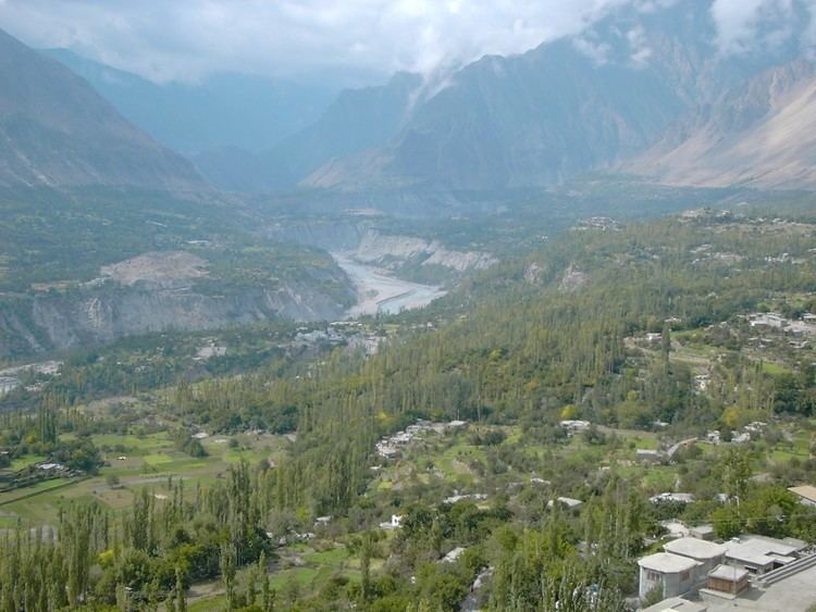
Today, the famous Karakoram Highway crosses Nagar, connecting Pakistan to China via the Khunjerab Pass. The road follows the Hunza river for some distance through Nagar and into the hunza region.
Location
The Nagar valley is situated at an elevation of 2,438m (7,999 feet). Nagar Khas is the main town and the capital of the former State of Nagar. Ghulmet, Minapin,BAR, Chaprote and Hopper Valleys are popular tourist attractions in the Nagar region because of the spectacular scenery of the surrounding mountains such as Rakaposhi at 7,788m (25,561 feet), and Diran, and Spantik peak (Golden peak.) It is situated at front of Hunza.
History
Following the Hunza-Nagar Campaign of 1889–1892 (known locally as the Anglo-Burusho war) the area passed under British control and then as a vassal of the Kashmir Durbar, but was ruled by the same royal family. In 1974, Zulfiqar Ali Bhutto dissolved the Princely States of Nagar and Hunza and gave democratic representation to the Northern Areas Council, now known as the Northern Areas Legislative Council.
Thum
The beautiful name for the ruler in Nagar was Thum, which is also a respectful appellation used by people of both Hunza and Nager who belong to the clan of Boorish.