
West end: N10 at Groblershoop | ||
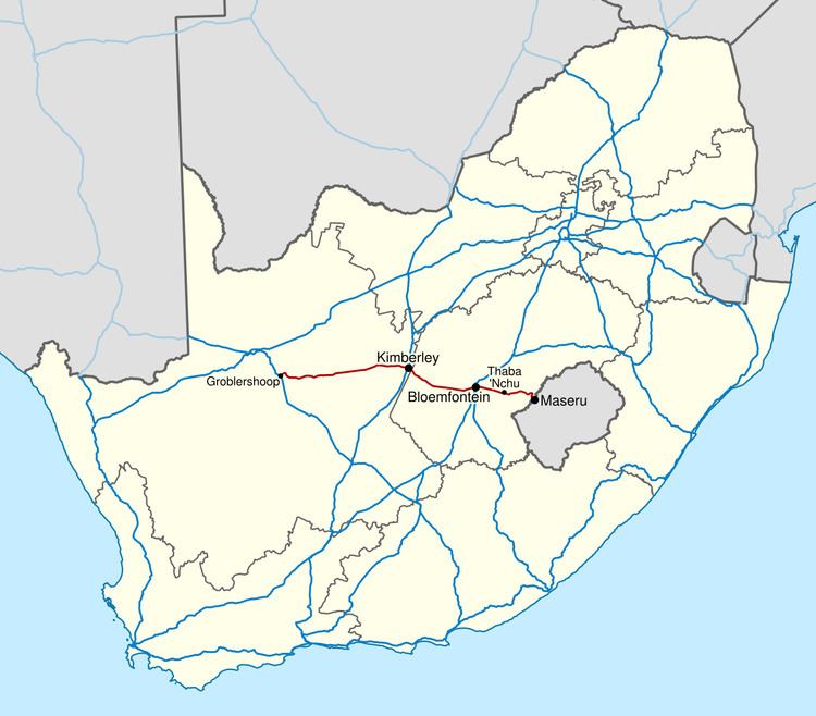 | ||
East end: Maseru Bridge at the Lesotho border Major cities Bloemfontein, Kimberley, Northern Cape, Thaba Nchu, Free State, Botshabelo, Maseru | ||
The N8 is a national route in South Africa that connects Upington, Kimberley, Bloemfontein and Maseru in Lesotho. It is maintained by the South African National Roads Agency.
Contents
Map of N8, South Africa
Route
The road starts at Groblershoop in the Northern Cape, at a junction with the N10 from Upington. It runs east through Griquatown to Kimberley. From Kimberley it runs south-east into the Free State, on a recently upgraded stretch of road, to Bloemfontein. East of Bloemfontein, the road runs through Botshabelo, Thaba Nchu and Ladybrand to end on the Lesotho border at Maseru Bridge.
References
N8 road (South Africa) Wikipedia(Text) CC BY-SA