
South end: N1 in Cape Town | ||
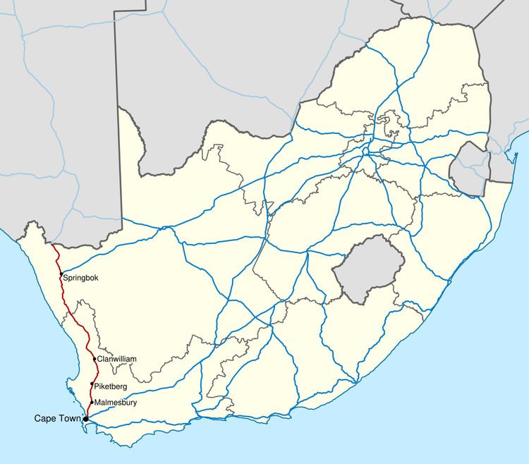 | ||
North end: B1 at the Namibian border at Vioolsdrif Major cities Cape Town, Malmesbury, Western Cape, Clanwilliam, Western Cape, Springbok, Vioolsdrif | ||
The N7 is a national route in South Africa that runs from Cape Town northwards through the West Coast and Namaqualand regions to the Namibian border at Vioolsdrif. After crossing the border, it changes designation to B1 and runs north through Windhoek and the north of Namibia.
Map of N7, South Africa
The portion of the road within Cape Town is a freeway, but it loses limited-access freeway status shortly after exiting the city limits at the M5 interchange (Potsdam Rd). From here it remains a dual-carriageway till the Melkbosstrand M19 intersection. Thereafter, the N7 is a single-carriageway highway with wide paved shoulders to Piekenierskloof Pass near Citrusdal; only a short 4km section through Malmesbury attains freeway status again along this section. The rest of the N7 to the Namibian border is a single-carriageway highway with no paved shoulders.